Navvies


Issue 129, Dec 1991
Report, Big Dig 91, Wantage
 The Melksham Link Waterway
The Melksham Link Waterway
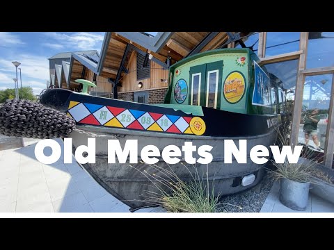
# 73 Narrowboat Vlog - Old Meets New
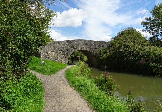
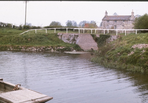
001 Semington Junction 1976
1976, Semington Junction
002 Entrance Lock Semington 900600 1978
1978, Entrance Lock Semington
003 Farm to railway crossing looking south 900615 1978
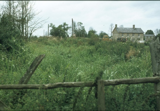
1978, Farm to railway crossing looking south
004 Canal from 1st crossing looking north 900612 1978
1978, Canal from 1st crossing looking north
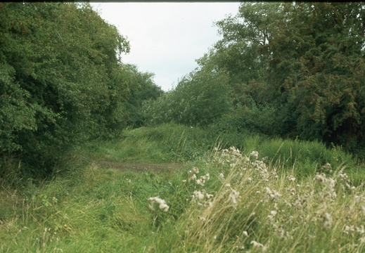
005 Melksham looking North 908640 1978
1978, Melksham looking North
006 Start of canal North of Melksham 911652 1978
1978, Start of canal North of Melksham
007 Melksham Forest Lock 911653 1978
1978, Melksham Forest Lock
008 Melksham Forest Lock 911653 1978
1978, Melksham Forest Lock
009 Melksham Forest Lock 911653 1978
1978, Melksham Forest Lock
01 St. Helen's Wharf
Abingdon Lock & River

St. Helen's Wharf (inscribed stone) Abingdon, Cast Iron Bridge erected as specified in Act of 1821 over River Ock, inscribed:- "Erected by the Wilts and Berks. Canal Company: AD 1824. Cast at Agramans Bristol" This bridge has been extended in width, otherwise it is a fine specimen of contemporary cast iron work.
D.L. Banfield Survey, 1969

010 Towards junction Calne Branch 958729 July 1977
1977, Towards junction Calne Branch
011 Charlcutt looking south 977756 july 1977
1977, Charlcutt looking south
012 979786 June 1979
1979, North of Foxham
013 Lacock 926688 July 1977
1977, Lacock
014 Site of Wood Common Lock 982789 June 1979
1979, Wood Common Lock
015 Site of Wood Common Lock June 1979
1979, Wood Common Lock
016 East from 980787 1979
1979, East from this location
017 From City Bridge 985796 1979
1979, City Bridge
018 Towards City Road Bridge 985795 June 1979
1979, Towards City Road Bridge
019 Wharf buildings Dauntsey Jan 1979
1979, Wharf buildings Dauntsey
02 Abingdon Lock & River
Abingdon Lock & River

Site of Lock, Wharf and Basin now Abingdon Laundry. Fine stone wharf store exists. Nissen hut stands directly on lock chamber. Lock rise was 9ft. 6 ins. (depending on level of Thames) to the canal.
D.L. Banfield Survey, 1969

020 Hope Cottage Dauntsey Jan 1979
1979, Hope Cottage Dauntsey
021 Hope Cottage Dauntsey Jan 1979
1979, Hope Cottage Dauntsey
022 Lock site and cottage Dauntsey Jan 1979
1979, Lock site and cottage Dauntsey
023 Canal and wharf buildings Dauntsey Jan 1979
1979, Canal and wharf buildings
024 Garage  canal route and lock site Dauntsey Jan 1979
1979, Garage canal route and lock site Dauntsey
025 Dauntsey canal and wharf Jan 1979
1979, Dauntsey canal and wharf
026 Dauntsey Lock Cottage Jan 1979
1979, Dauntsey Lock Cottage
027 Dauntsey Wharf entrance Weighbridge Jan 1979
1979, Dauntsey Wharf entrance Weighbridge
028 Hope House  weighbridge  A420 Dauntsey Jan 1979
1979, Hope House weighbridge A420 Dauntsey
029 Wharf Buildings Dauntsey Jan 1979
1979, Wharf Buildings Dauntsey
03 - Cambria Bridge
2024, Cambia Road Bridge 360
03 Ardington Marsh Lock
Ardington Marsh Lock

Ardington Marsh Lock, exists, rises 9ft. 5 ins. Rotten gates at bottom level.
D.L. Banfield Survey, 1969

030 Canal east of Dauntsey Jan 1979
1979, Canal east of Dauntsey
031 Dauntsey 1985
1985, Dauntsey
032 Dauntsey 1985
1985, Dauntsey
033 Dauntsey 1985
1985, Dauntsey
034 Dauntsey 1985
1985, Dauntsey
035 Dauntsey 1985
1985, Dauntsey
036 Lock Seven Locks 024811 1976
1976, Lock Seven Locks
037 Lock Seven Locks 024811 1976
1976, Lock Seven Locks
038 Lock Tockenham wick 024811 1976
1976, Lock Tockenham wick
039 Tockenham Area June 1978
1978, Tockenham Area
04 Milestone
Milestone

Milestone, inscription illegible (not marked on 25" Ordnance Survey of 1876). [46.5 Miles to Semington. Miletone shown on 25" OS map XIV.3 Revised 1910, Published 1912. Gary K]
D.L. Banfield Survey, 1969

040 Stop plank grooves Tockenham 035814 June 1978
1978, Stop plank grooves Tockenham
041 Near Hart Farm June 1978
1978, Near Hart Farm
042 Near Hart Farm June 1978
1978, Near Hart Farm
043 Hart Farm Bridge June 1978
1978, Hart Farm Bridge
044 Hart Farm Bridge June 1978
1978, Hart Farm Bridge
045 Vastern Wharf 053816 1976
1976, Vastern Wharf
046 Dunnington Aqueduct South Side 062815 June 1978
1978, Dunnington Aqueduct South Side
047 Near Dunnington Locks June 1978
1978, Near Dunnington Locks
047541E
Image credit: RCHS. 1962, River Ray Aqueduct from SW.
047542E
Image credit: RCHS. 1962, River Ray Aqueduct from SW.
047543E
Image credit: RCHS. 1962, "Lengthmen's cottages near Ray Aqueduct, between Ray Aqueduct and Ray Farm. Viewed from bed of canal now filled in."
047544E
Image credit: RCHS. 1962, Pry Lock. View southwards from accommodation bridge
047545E
Image credit: RCHS. 1962, Pry Lock & cottages.
047546E
Image credit: RCHS. 1962, Remains of accommodation bridge at Hayes Knoll - south of Cricklade.
047547E
Image credit: RCHS. 1962, "River Key Aqueduct. South of Cricklade near Broadleaze Farm"
047548E
Image credit: RCHS. 1962, "River Key Aqueduct. South of Cricklade near Broadleaze Farm"
047549E
Image credit: RCHS. 1962, "Embankment NW of Key aqueduct. Taken looking NW from R Key aqueduct"
047550E
Image credit: RCHS. 1962, Wharf buildings, Cricklade.
047551E
Image credit: RCHS. 1962, Wharf buildings, Cricklade.
047552E
Image credit: RCHS. 1962, View south from Cricklade tunnel
047553E
Image credit: RCHS. 1962, South end of Cricklade tunnel.
047554E
Image credit: RCHS. 1964, Looking towards Latton Junction.
047555E
Image credit: RCHS. 1964, Latton Junction with Thames & Severn Canal.
048 East of Dunnington Aqueduct 063815 June 1978
1978, East of Dunnington Aqueduct
048631E
Image credit: RCHS. 1962, Wootton Bassett Lock: remains of quion posts. Lock was turf-sided as was top lock. Fall 8' 3
048632E
Image credit: RCHS. 1964, Wroughton Wharf buildings.
048633E
Image credit: RCHS. 1964, Wroughton Wharf buildings.
048634E
Image credit: RCHS. 1964, Wroughton Wharf buildings.
048635E
Image credit: RCHS. 1964, Remains of Pewsham Top Lock.
048636E
Image credit: RCHS. 1964, Remains of Pewsham Bottom Lock.
048637E
Image credit: RCHS. 1964, Paddle gear recess Pewsham bottom lock.
048638E
Image credit: RCHS. 1964, "Junction basin with Kennet & Avon Canal at Semington. Sunken boat with wooden cabin on left"
048639E
Image credit: RCHS. 1964, Junction with Kennet & Avon Canal at Semington.
048640E
Image credit: RCHS. 1964, Junction with Chippenham Branch (on right).
048641E Melksham Wharf & Wharf House
Image credit: RCHS. 1964, Melksham Wharf & Wharf House.
048642E
Image credit: RCHS. 1964, Looking towards Chaddington Lock.
048643E
Image credit: RCHS. 1964, Remains of Woodshaw Lock.
048644E
Image credit: RCHS. 1964, Remains of Woodshaw Lock. "Brickwork partly dismantled"
048645E
Image credit: RCHS. 1964, Site of Woodshaw Lock.
048646E
Image credit: RCHS. 1964, Bed of canal between Chaddington and Summit locks.
048647E
Image credit: RCHS. 1964, Canalside buildings.
048650E
Image credit: RCHS. 1964, Calne Branch: Calne basin stables.
048651E
Image credit: RCHS. 1964, Calne Branch: Calne basin stables.
048652E
Image credit: RCHS. 1964, Calne Branch: Paddle gear, Calne Lock.
048653E
Image credit: RCHS. 1964, Calne Branch: West end Calne Tunnel.
048654E
Image credit: RCHS. 1964, Calne Branch: West end Calne Tunnel.
048655E
Image credit: RCHS. 1964, Calne Branch: East end Calne Tunnel.
048656E
Image credit: RCHS. 1964, Calne Branch: View west from Calne Tunnel.
048657E
Image credit: RCHS. 1964, Marden aqueduct, Stanley.
048658E
Image credit: RCHS. 1964, Marden aqueduct, Stanley.
048659E
Image credit: RCHS. 1964, Marden aqueduct, Stanley.
048660E
Image credit: RCHS. 1964, Stanley bottom lock.
048661E
Image credit: RCHS. 1964, Stanley bottom lock.
048662E
Image credit: RCHS. 1964, "Stanley top lock. Arrows on slide mount show main line to left, Calne Branch to right"
048663E
Image credit: RCHS. 1964, Lock House and wharf, Seven Locks, Tockenham.
048664E
Image credit: RCHS. 1964, Paddle gear, Top Lock, Seven locks, Tockenham.
048665E
Image credit: RCHS. 1964, Top lock, Seven Locks, Tockenham.
048666E
Image credit: RCHS. 1964, Wootton Bassett Aqueduct, Greenhill Common.
048667E
Image credit: RCHS. 1964, Bottom Lock, Wootton Basset.
048668E
Image credit: RCHS. 1964, Summit Level looking W down chamber.
048669E
Image credit: RCHS. 1964, Summit Level looking east; view of (top lock?) chamber.
048670E
Image credit: RCHS. 1964, Remains of aqueduct over river Cole.
048671E
Image credit: RCHS. 1964, GWR Bridge over canal line at Marston.
048672E
Image credit: RCHS. 1964, Longcot wharf house, Longcot Branch.
048673E
Image credit: RCHS. 1964, Longcot wharf, Longcote Branch.
048674E
Image credit: RCHS. 1964, Looking W towards Longcote locks.
048675E
Image credit: RCHS. 1964, View East from Longcote Top Lock.
048676E
Image credit: RCHS. 1964, Uffington Wharf.
048677E
Image credit: RCHS. 1964, Uffington Wharf.
048678E
Image credit: RCHS. 1964, Lowered road bridge at West Challow.
048679E
Image credit: RCHS. 1964, Nalder & Nalder Ltd, Ironworks, East Challow. Dragonfly Articles: No 1, No 2
048680E
Image credit: RCHS. 1964, Grove Bottom Lock.
048681E
Image credit: RCHS. 1964, View east from Grove bottom lock.
048682E
Image credit: RCHS. 1964, Looking E through Cow Common Bridge, Steventon.
048683E
Image credit: RCHS. 1964, Cow Common Bridge, Steventon.
048684E
Image credit: RCHS. 1964, Cow Common Bridge, Steventon looking west.
048685E
Image credit: RCHS. 1964, Looking West along canal to Cow Common [Steventon] Lock.
048686E
Image credit: RCHS. 1964, Sluice chamber, Steventon Lock.
048687E
Image credit: RCHS. 1964, View east into Steventon Lock.
048688E
Image credit: RCHS. 1964, Steps up wall tail, Steventon Lock.
048689E
Image credit: RCHS. 1964, View East towards Drayton Lock.
048690E
Image credit: RCHS. 1964, "Wilts & Berks Canal: Looking East to locks filled in. Location unknown: Drayton/Steventon?"
048691E
Image credit: RCHS. 1964, Bed of canal now filled in looking over Drayton Moor from lock 1.
048692E
Image credit: RCHS. 1964, Looking over R Thames towards Abingdon Wharf.
048693E
Image credit: RCHS. 1964, Abingdon wharves and River Thames. Entrance to Wilts & Berks Canal.
048694E
Image credit: RCHS. 1964, Wilts & Berks Canal: Entrance to Wilts & Berks Canal.
049 Bridge over B4041 June 1978
1978, Bridge over B4041
05 - Commercial Road/ Milton Road Bridge
360
05 Ardington Top Lock
Ardington Top Lock

Ardington Top Lock, rise 9ft. 5ins. Superb example of Lock left to decay • Ground paddle gear exists, top gate gone, bottom gates stand Lock cottage derelict.
D.L. Banfield Survey, 1969

050 The old Bridge Inn June 1978
1978, The old Bridge Inn
051 Wootton Bassett Spring 1978
1978, Wootton Bassett
052 Templar s Firs Spring 1978
1978, Templars Firs
053 Looking west Templar s Firs 074816 May1979
1979, Looking west Templars Firs
054 Drainpipes Templar s Firs 1981
1981, Drainpipes Templars Firs
055 Probably Templars Firs 1981
1981, Probably Templars Firs
056 Drainpipes Templar s Firs 1981
1981, Drainpipes Templars Firs
057 Bradleys pipes Templar s Firs 1981
1981, Bradleys pipes Templars Firs
058 Bradleys pipes Templar s Firs 1981
1981, Bradleys pipes Templars Firs
059 Bradleys pipes crossing Templar s Firs 1981
1981, Bradleys pipes crossing Templars Firs
06 Pill Ditch Culvert
Pill Ditch Culvert

Fine culvert of Swindon stone for stream by Nevilles Farm. Farm bridge (arch) extinct.
D.L. Banfield Survey, 1969

060 Bradleys pipes Templar s Firs 1981
1981, Bradleys pipes crossing Templars Firs
061 Strengthened Culvert Templar s Firs 1981
1981, Strengthened Culvert Templars Firs
062 Bridge 085818 looking west to Wootton Bassett 1978
1978, Woodshaw Bridge looking west to Wootton Bassett
063 Near Summit Lock June 1978
1978, Near Summit Lock
064 Summit Lock June 1978
1978, Summit Lock
065 Summit Lock towards Chaddington June 1978
1978, Summit Lock towards Chaddington
066 Looking East Chaddington Lock site from 085818 spring 197
1978, Looking East Chaddington Lock site
067 Summit Lock June 1978
1978, Summit Lock
068 Chaddington Lane bridge looking east 1976
1976, Chaddington Lane bridge looking east
069 Remains of Chaddington Lock looking west June 1978
1978, Remains of Chaddington Lock looking west
07 Grove Bottom Lock
Grove Bottom Lock

Grove Bottom Lock rise 9ft. gins., exists. lop sill and side chambers in good condition (chamber only 7ft. bins. wide - of., 8 ft. on other locks) probably rebuilt.
D.L. Banfield Survey, 1969

070 Chaddington Lane bridge looking 095815 July 1977
1977, Chaddington Lane bridge
071 Chaddington Lane bridge looking east Spring 1978
1978, Chaddington Lane bridge looking east
072 Chaddington Lane bridge looking east June 1978
1978, Chaddington Lane bridge looking east
073 Chaddington Lock Cottage c 1977
1977, Chaddington Lock Cottage
074 Chaddington Lock Cottage June 1978
1978, Chaddington Lock Cottage
074631E
Image credit: RCHS. 1830, Calne, Town Lock, Artist: William Westall
074632E
Image credit: RCHS. c1980's, Bremhill Stanley Aqueduct over the river Marden
074633E
Image credit: RCHS. 1912, Swindon, North Wilts canal heading off north out of the bottom of picture in 1912.
074634E
Image credit: RCHS. c1980's, Swindon, skew railway bridge looking north
074635E
Image credit: RCHS. c1980's, Swindon, standing on Skew railway bridge looking north
074636E
Image credit: RCHS. c1980's, Swindon, Skew railway bridge looking south
074637E
Image credit: RCHS. c1980's, Swindon, towpath between Kingshill and Skew bridge, looking south
074638E
Image credit: RCHS. c1980's, Swindon, Cambria road bridge, looking west.
074639E
Image credit: RCHS. c1980's, Swindon, Milton road bridge, looking east
074640E
Image credit: RCHS. c1980's, Swindon town centre, known as canal walk, standing at the former Golden Lion bridge, looking west
074641E
Image credit: RCHS. c1980's, Swindon town centre, Grade 2 listed milestone from 1804
074642E
Image credit: RCHS. c1980's, Swindon town centre, known as canal walk, standing at the former Golden Lion bridge, looking east
074643E
Image credit: RCHS. c1980's, Swindon town centre, former canal junction, looking north.
074644E
Image credit: RCHS. c1980's, Wantage branch, Wharf entrance.
074645E
Image credit: RCHS. c1980's, Abingdon, River Ock Bridge
074646E
Image credit: RCHS. c1880's, Abingdon, St Helens Wharf
074651E
Image credit: RCHS. 1987, North Wilts Canal. West side of long bridge under railway. Standing on the site of the former Bullen's bridge. Looking NW
074653E
Image credit: RCHS. 1987, North Wilts Canal. near Moreden, Swindon. Preserved section.
074654E
Image credit: RCHS. 1987, North Wilts Canal. East end of aqueduct over River Key.
074655E
Image credit: RCHS. 1987, North Wilts Canal. West end of aqueduct over River Key.
074656E
Image credit: RCHS. 1987, North Wilts Canal. Latton Basin.
074657E
Image credit: RCHS. 1896, North Wilts Canal. Latton. Steam passenger barge. This is one of the steam boats used by de Salis compiling Bradshaw's, probably Dragonfly.
075 Summit Lock looking west June 1978
1978, Summit Lock looking west
076 West from Chaddington Bridge 1976
1976, West from Chaddington Bridge
077 Chaddington Bridge c 1977
1977, Chaddington Lane Bridge
078 Chaddington Lane east spring 1978
1978, Chaddington Lane east
079 Chaddington Lane Bridge west Spring 1978
1978, Chaddington Lane Bridge west
08 Smallmarsh Lock
Smallmarsh Lock

Small March, Lock, rises 9ft. Sins., derelict. West end filled and converted to farm road. At east end gates gone but water in bed, heel post exists.
D.L. Banfield Survey, 1969

080 Wharf Farm Hay Lane June 1978
1978, Wharf Farm Hay Lane
081 Hay Lane west June 1978
1978, Hay Lane west
082 Wharf Farm 129822 June 1978
1978, Wharf Farm
083 Hay Lane east June 1978
1978, Hay Lane east
084 Towards Swindon 120821 June 1978
1978, Towards Swindon
085 Bridge to Hay Lane Farm 115825 June 1978
1978, Berrywood Bridge to Hay Lane Farm
086 Bridge 115822 June 1978
1978, Berrywood Bridge
087 Towards M4 from West Leaze Spring 1978
1978, Towards M4 from West Leaze
088 Near Swindon looking south 132827 July 1978
1978, Near Swindon looking south
089 Near Swindon looking north 132827 July 1978
1978, Near Swindon looking north
09 Grovecommon Lock
Grovecommon Lock

Grovecommon Lock, rises 9ft. 3ins., This has an integral brick bridge over the west end of the chamber. Gauging stone set in wall.
D.L. Banfield Survey, 1969

090 M SWJ Bridge July 1977
1977, M&SWJ Bridge
091 M SWJ Bridge July 1977
1977, M&SWJ Bridge
092 From M SWJ Bridge July 1977
1977, From M&SWJ Bridge
093 Kingshill Swindon spring 1978
1978, Kingshill Swindon
094 M SWJ Bridge spring 1978
1978, M&SWJ Bridge
095 Beneath M SWJ Bridge spring 1978
1978, Beneath M&SWJ Bridge
096 beneath M SWJ Bridge spring 1978
1978, Beneath M&SWJ Bridge
097 Towards Wootton Bassett from M SWJ Bridge spring 1978
1978, Towards Wootton Bassett from M&SWJ Bridge
098 Kingshill Swindon spring 1978
1978, Kingshill Swindon
099 South side of River Ray Aqueduct spring 1978
1978, South side of River Ray Aqueduct
1 Latton Canal Stop Lock
c1895
1.01.1 Abingdon (280n)
1960, Abingdon, looking north west, at the canal junction to the river Thames
Colourised
1.01.1 Abingdon (280n)
1960, Abingdon, looking north west, at the canal junction to the river Thames.
AI Enhanced
1.01.2 Abingdon (346n)
1960, Abingdon, Wharf House
AI Enhanced
1.01.2 Abingdon (346n)
1960, Abingdon, Wharf House
Colourised
1.02 Abingdon (274n)
1960, Abingdon, looking west from the Basin
Colourised
1.02 Abingdon (274n)
1960, Abingdon, looking west from the Basin
AI Enhanced
1.05.1 Abingdon (262n)
1960, Abingdon, Caldecott, looking east from occupation bridge
AI Enhanced
1.05.1 Abingdon (262n)
1960, Abingdon, Caldecott, looking east from occupation bridge
Colourised
1.05.2 Abingdon (263n)
1960, Abingdon, Caldecott, looking west from occupation bridge
AI Enhanced
1.05.2 Abingdon (263n)
1960, Abingdon, Caldecott, looking west from occupation bridge
Colourised
1.05.3 Abingdon (264n)
1960, Abingdon, Caldecott , probable Masonry from the Lock
AI Enhanced
1.05.3 Abingdon (264n)
1960, Abingdon, Caldecott , probable Masonry from the Lock
Colourised
1.05.4 Abingdon (275n)
1960, Abingdon, looking west from occupation bridge near New Cut Mill
Colourised
1.05.4 Abingdon (275n)
1960, Abingdon, looking west from occupation bridge near New Cut Mill
AI Enhanced
1.07.1 East Vale (276n)
1960, East Vale, looking east from Drayton occupation bridge
Colourised
1.07.1 East Vale (276n)
1960, East Vale, looking east from Drayton occupation bridge
AI Enhanced
1.07.2 East Vale (277n)
1960, East Vale, looking west from Drayton occupation bridge
Colourised
1.07.2 East Vale (277n)
1960, East Vale, looking west from Drayton occupation bridge
AI Enhanced
1.09 East Vale (278n)
1960, East Vale, Basin, adjacent to Steventon Lock
Colourised
1.09 East Vale (278n)
1960, East Vale, Basin, adjacent to Steventon Lock
AI Enhanced
1.10.1 East Vale (265n)
1960, East Vale, looking east from Cow Common bridge
AI Enhanced
1.10.1 East Vale (265n)
1960, East Vale, looking east from Cow Common bridge
Colourised
1.10.2 East Vale (266n)
1960, East Vale, looking west, at Cow Common bridge
AI Enhanced
1.10.2 East Vale (266n)
1960, East Vale, looking west, at Cow Common bridge
Colourised
1.10.3 East Vale (267n)
1960, East Vale, Arch of Cow Common Bridge
AI Enhanced
1.10.3 East Vale (267n)
1960, East Vale, Arch of Cow Common Bridge
Colourised
1.11 East Vale (474n)
1960, East Vale, Ardington Marsh Lock
Colourised
1.11 East Vale (474n)
1960, East Vale, Ardington Marsh Lock
AI Enhanced
1.12.1 East Vale (268n)
1960, East Vale, looking north by "Canalside Cottages"
Colourised
1.12.1 East Vale (268n)
1960, East Vale, looking north by "Canalside Cottages"
AI Enhanced
1.12.2 East Vale (269n)
1960, East Vale, looking south by "Canalside Cottages"
Colourised
1.12.2 East Vale (269n)
1960, East Vale, looking south by "Canalside Cottages"
AI Enhanced
1.13.1 East Vale (539n)
1962, East Vale, looking east, Ardington Top Lock, internal
Colourised
1.13.1 East Vale (539n)
1962, East Vale, looking east, Ardington Top Lock, internal
AI Enhanced
1.13.2 East Vale (279n)
1960, East Vale, Quarter mile above Ardington Top Lock
Colourised
1.13.2 East Vale (279n)
1960, East Vale, Quarter mile above Ardington Top Lock
AI Enhanced
1.14 East Vale (271n)
1960, East Vale, looking west from Occupation Bridge leading to Neville's Farm
Colourised
1.14.2 East Vale (328n)
1960, East Vale, looking west from road crossing, Pinmarsh bridge
Colourised
1.14.2 East Vale (328n)
1960, East Vale, looking west from road crossing, Pinmarsh bridge
AI Enhanced
1.15.1 East Vale (329n)
1960, East Vale, looking west from Grove Bottom Lock
Colourised
1.15.1 East Vale (329n)
1960, East Vale, looking west from Grove Bottom Lock
AI Enhanced
1.15.2 East Vale (298n)
1960, East Vale, Occupation bridge, west of Grove Bottom Lock
Colourised
1.15.2 East Vale (298n)
1960, East Vale, Occupation bridge, west of Grove Bottom Lock
AI Enhanced
1.16 East Vale (478n)
1962, East Vale, looking east from Spirit Lock
Colourised
1.16 East Vale (478n)
1962, East Vale, looking east from Spirit Lock
AI Enhanced
1.17 East Vale (283n)
1960, East Vale, infilled line west of Smallmarsh Lock
AI Enhanced
1.17 East Vale (283n)
1960, East Vale, infilled line west of Smallmarsh Lock
Colourised
1.19 East Vale (479n)
1960, East Vale, Grove, House on west bank, probable canalside Inn/ Public House
AI Enhanced
1.19 East Vale (479n)
1960, East Vale, Grove, House on west bank, probable canalside Inn/ Public House
Colourised
1.20.1 East Vale (284n)
1960, East Vale, Grove, Osmond Cottages on west bank from road aspect, former Blacksmiths & Hostel
Colourised
1.20.1 East Vale (284n)
1960, East Vale, Grove, Osmond Cottages on west bank from road aspect, former Blacksmiths & Hostel.
AI Enhanced
1.20.2 East Vale (482n)
1962, East Vale, Grove, Cottages on west bank from canal aspect
AI Enhanced
1.20.2 East Vale (482n)
1962, East Vale, Grove, Cottages on west bank from canal aspect
Colourised
1.21 East Vale (272n)
1960, East Vale, looking west approximatley 500 yards above Grove bridge
Colourised
1.21 East Vale (272n)
1960, East Vale, looking west approximatley 500 yards above Grove bridge
AI Enhanced
10 Letcombe Brook Aqueduct

Aqueduct rebuilt over Wantage river (Ginge Brook) as required in Enabling Act of 1894.
D.L. Banfield Survey, 1969

100 North side of River Ray Aqueduct spring 1978
1978, North side of River Ray Aqueduct
101 Towards Kingshill from West Leaze spring 1978
1978, Towards Kingshill from West Leaze
102 Kingshill spring 1978
1978, Kingshill
103 Kingshill spring 1978
1978, Kingshill
104 M SWJ bridge Kingshill June 1978
1978, M&SWJ bridge Kingshill
105 M SWJ bridge Kingshill June 1978
1978, M&SWJ bridge Kingshill
106 Work at Kingshill 6th August 1978
1978, Work at Kingshill
107 Kingshill 6th August 1978
1978, Kingshill
108 Work at Kingshill 6th August 1978
1978, Work at Kingshill
109 Work at Kingshill 6th August 1978
1978, Work at Kingshill
11 Limekiln Lock

Linekiln Lock, rises 8ft. 9ins., part filled with rubbish and derelict. Facing brickwork, English bond, 9" x 4" x 2 3/4".
D.L. Banfield Survey, 1969

110 Kingshill work experience clearance Jan 1979
1979, Kingshill work experience clearance
111 Kingshill Summer 1979
1979, Kingshill Summer
112 TWA pipe Kingshill Jan 1979
1979, TWA pipe Kingshill
113 TWA pipe Kingshill Jan 1979
1979, TWA pipe Kingshill
114 Kingshill Summer 1979
1979, Kingshill Summer
115 Kingshill Summer 1979
1979, Kingshill Summer
116 Kingshill Summer 1980
1980, Kingshill Summer
117 Kingshill Summer 1980
1980, Kingshill Summer
118 Swindon April 1977
1977, Swindon looking south
119 Cambria Bridge April 1977
1977, Cambria Road Bridge
12 Grove Wharf

Grove Wharf, 4 wharf cottages and old public house still inhabited.
D.L. Banfield Survey, 1969

120 Tow rope marks Cambria bridge Oct 1977
1977, Tow rope marks Cambria bridge
121 Tow rope marks west side Cambria bridge Aug 1978
1978, Tow rope marks west side Cambria bridge
122 Cambria Bridge repairs 6th Aug 1978
1978, Cambria Bridge repairs
123 Cambria Bridge repairs 6th Aug 1978
1978, Cambria Bridge repairs
124 Tow path sign near Milton Road bridge 1977
1977, Tow path sign near Milton Road bridge
125 Towards Milton Road Bridge
1977, Towards Milton Road Bridge
126 Milton Road bridge 1977
1977, Milton Road bridge
127 Towards Milton Road bridge
1977, Towards Milton Road bridge
128 Milton Road bridge June 1978
1978, Milton Road bridge
129 The Parade Swindon 1977
1977, Canal Walk
13 Belmont Bridge

Belmont stone carriage bridge. Semi-circular stone. arch still exists, being destroyed by children.
D.L. Banfield Survey, 1969

130 Swindon milepost 1977
1977, Swindon milepost
131 Golden Lion Swindon June 1978
1978, Golden Lion Swindon by Carlton Attewood. Newspaper article
132 Golden Lion Bridge painting 1977
1977, Golden Lion Bridge Mural by Ken White
133 Fleming Way Swindon Oct 1977
1977, Fleming Way Swindon
134 York Road Bridge 1978
1978, York Road Bridge
135 York Road Bridge 1978
1978, York Road Bridge
136 Marsh Farm Bridge
1977, Marsh Farm Bridge
137 Marsh Farm Bridge
1977, Marsh Farm Bridge
138 Marsh Farm Bridge infilled
1977, Marsh Farm Bridge
139 Alternative route swindon east 186858
1978, Alternative route swindon east
14 Wantage Junction

Junction with Wantage Branch.
D.L. Banfield Survey, 1969

140 Stratton Park 188863 1977
1977, Stratton Park
141 Stratton Park 1977
1977, Stratton Park
142 Canal 226879 Oct 1977
1977, Canal bed
143 Site of Marston Locks Oct 1977
1977, Canal bed
144 Acorn Bridge over A420 218874
1978, Acorn Bridge over A420
145 Shrivenham Bridge B4000
1977, Shrivenham/ Station Road Bridge
146 Shrivenham Bridge B4000 Dec 1978
1978, Shrivenham/ Station Road Bridge
147 Shrivenham Bridge B4000 Dec 1978
1978, Shrivenham/ Station Road Bridge
148 Shrivenham Bridge B4000 Dec 1978
1978, Shrivenham/ Station Road Bridge
149 Shrivenham Bridge B4000 Dec 1978
1978, Shrivenham/ Station Road Bridge
15 Wantage Basin

Wantage Basin. Wharfinger house, Wharf store, stable, tack room, weighbridge and toll house all exist in dilapidated condition. This site will be redeveloped soon. it's buildings are original.
D.L. Banfield Survey, 1969

150 Shrivenham Bridge B4000 Dec 1978
1978, Shrivenham/ Station Road Bridge
151 Shrivenham Bridge B4000 Dec 1978
1978, Shrivenham/ Station Road Bridge
152 Shrivenham Bridge B4000 Dec 1978
1978, Shrivenham/ Station Road Bridge
153 Shrivenham Bridge B4000 Dec 1978
1978, Shrivenham/ Station Road Bridge
154 Shrivenham Bridge B4000 Sept 1979
1979, Shrivenham/ Station Road Bridge
155 Shrivenham B4000 Sept 1979
1979, Shrivenham/ Station Road Bridge
156 Shrivenham B4000 Sept 1979
1979, Shrivenham/ Station Road Bridge
157 Shrivenham Bridge B4000 Sept 1979
1979, Shrivenham/ Station Road Bridge
158 Shrivenham Bridge B4000 Sept 1979
1979, Shrivenham/ Station Road Bridge
159 Towpath Shrivenham B4000 Sept 1979
1979, Shrivenham/ Station Road Bridge
16 East Challow Wharf

Challow wharf and Iron Foundry and Bridge (extinct). (Survey required of Iron Foundry).
D.L. Banfield Survey, 1969

160 Towpath Shrivenham B4000 Sept 1979
1979, Shrivenham/ Station Road Bridge
161 Shrivenham B4000 autumn 1979
1979, Shrivenham/ Station Road Bridge
162 Shrivenham B4000 spring 1981
1981, Shrivenham/ Station Road Bridge
163 Shrivenham B4000 spring 1981
1981, Shrivenham/ Station Road Bridge
164 Shrivenham B4000 spring 1981
1981, Shrivenham/ Station Road Bridge
165 Shrivenham B4000 spring 1981
1981, Shrivenham/ Station Road Bridge
166 Shrivenham B4000 spring 1981
1981, Shrivenham/ Station Road Bridge
167 Shrivenham B4000 spring 1981
1981, Shrivenham/ Station Road Bridge
168 Shrivenham B4000 spring 1981
1981, Shrivenham/ Station Road Bridge
169 Shrivenham B4000 spring 1981
1981, Shrivenham/ Station Road Bridge
17 Woolstone Brook Aqueduct

Aqueduct of brick, 6ft. wide x 4ft. high over Woolstone brook. To west of this embankment 6ft high runs to Uffington wharf 250 yds. away.
D.L. Banfield Survey, 1969

170 North from B4508 Longcot 268901 Jan 1979
1979, Lost City Bridge looking North from B4508 Longcot
171 South from B4508 Longcot 268901 Jan 1979
1979, Lost City Bridge looking South from B4508 Longcot
172 West from Uffington Arch Bridge spring 1982
1982, West from Uffington Arch Bridge
173 East from Uffington Arch Bridge spring 1982
1982, East from Uffington Arch Bridge
174 West Challow looking west 369883 Oct 1977
1979, West Challow looking west
175 Towpath east from West Challow Bridge 369883 Jan 1979
1979, Towpath east from West Challow Bridge
176 Towpath east from West Challow Bridge 370883 Jan 1979
1979, Towpath east from West Challow Bridge
177 Looking east from West Challow Bridge spring 1982
1982, Looking east from West Challow Bridge
178 West Challow spring 1982
1982, West Challow
179 Looking west from West Challow Bridge spring 1982
1982, Looking west from West Challow Bridge
18 G.W.R Viaduct

G.W.R. viaduct over canal. Foundation of parapet exists on south embankment. On north embankment the brick arch sides exist.
D.L. Banfield Survey, 1969

180 East Challow 377884 Oct 1977
1977, East Challow
181 East Challow 382884 Oct 1977
1977, East Challow
182 Remains of Kings Lift Bridge Spring 1979
1979, Remains of Kings/ Cornhill lane Lift Bridge
1824, St Helens Wharf tablet, Ock north bank
1824, St Helens Wharf tablet, Ock north bank. Copyright Martin Buckland
1824, W&B Wharf tablet
1824, W&B Wharf tablet. Copyright Martin Buckland
183 Remains of Kings Lift Bridge Spring 1979
1979, Remains of Kings/ Cornhill lane Lift Bridge
184 Remains of Kings Lift Bridge Spring 1979
1979, Remains of Kings/ Cornhill lane Lift Bridge
185 Kings Lift Bridge Autumn 1979
1979, Remains of Kings/ Cornhill lane Lift Bridge
186 Kings Lift Bridge Autumn 1979
1979, Remains of Kings/ Cornhill lane Lift Bridge
187 Kings Lift Bridge Autumn 1979
1979, Remains of Kings/ Cornhill lane Lift Bridge
188 Kings Lift Bridge Autumn 1979
1979, Remains of Kings/ Cornhill lane Lift Bridge
189 Kings Lift Bridge Autumn 1979
1979, Remains of Kings/ Cornhill lane Lift Bridge
1893, Semington stop lock
Semington Junction. Lock seen from K&A looking under bridge.
Drawing from The Pall Mall magazine article from 1893 by Reginald Blunt, artist "Tim".
19 Longcot Bottom Lock

Longcot Bottom Lock, rises 9ft. 5ins. East end filled with footbridge over. Top end of chamber unfilled.
D.L. Banfield Survey, 1969

190 Kings Lift Bridge Autumn 1979
1979, Remains of Kings/ Cornhill lane Lift Bridge
1900 approx. Looking northwards, Spa bridge behind
c1900, Looking northwards, Spa bridge behind, Gallows footbridge ahead, rope factory on the right
1900 approx. Melksham wharf
c1900, Melksham Wharf, C1900
191 East Challow east towards A417 spring 1982
1982, East Challow east towards A417
1910 approx. Looking northwards towards Lowbourne Bridge
c1910, Looking northwards towards Lowbourne Bridge
1916, Lowbourne Bridge
1916, Lowbourne Bridge, between Melksham & Melksham Forest
County Main Road
1916, Spa Road Bridge
County Main Road
192 Hiskins infill East Challow spring 1982
1982, Hiskins infill East Challow
1920, Bottom right hand corner, follow canal into the town centre
Image credit: Britain from Above or Historic England

1920, Bottom right hand corner, follow canal into the town centre, Kingshill bridge, Marlborough St bridge, Cambria bridge, Commercial Rd bridge

193 Hiskins infill East Challow spring 1982
1982, Hiskins infill East Challow
1933, Melksham Wharf & Bridge, middle right
Image credit: Britain from Above (1933) and Heritage England Melksham Wharf & Bridge, middle right
1935, Melksham Wharf & Bridge, bottom middle
Image credit: Britain from Above (1935) and Heritage England Melksham Wharf & Bridge, bottom middle
1935, Melksham Wharf & Bridge, middle right
Image credit: Britain from Above (1935) and Heritage England Melksham Wharf & Bridge, middle right
194 East Challow looking east spring 1982
1982, East Challow looking east
195 East Challow looking east spring 1982
1982, East Challow looking east
1950, approx. Location of former Kingshill Bridge
Image credit: Local Studies, Swindon Central Library. 1950, approx. Location of former Kingshill Bridge
196 East Challow west of A417 May 1985
1985, East Challow west of A417
1969: MEMORIES of the NARROW BOAT MEN | Yesterday's Witness | Voice of the People | BBC Archive
Memories of Narrow Boat men - 1969
197 Remains of Stockham Bridge 391888 Jan 1979
1979, Remains of Stockham Bridge
198 East from Hunters Bridge Jan 1979
1979, East from Hunters Bridge
199 Looking west from Barwell Bridge site 394891 June 1979
1979, Looking west from Barwell Bridge site
1990, Pewsham Top Lock
1998, Dunnington Lock
2. Swindon GWR175 - North Wilts Canal Wharf
GWR175: North Wilts Canal Wharf
2.1.1 Wantage Branch (204n)
1959, Wantage branch, Wharf Warehouse & Granary, built 1830
Colourised
2.1.1 Wantage Branch (204n)
1959, Wantage branch, Wharf Warehouse & Granary, built 1830
AI Enhanced
2.1.2 Wantage Branch (205n)
1959, Wantage branch, Wharf House
Colourised
2.1.2 Wantage Branch (205n)
1959, Wantage branch, Wharf House.
AI Enhanced
2.1.3 Wantage Branch (354n)
1961, Wantage branch, Wharf Weighbridge Building called the "Sack House"
Colourised
2.1.3 Wantage Branch (354n)
1961, Wantage branch, Wharf Weighbridge Building called the "Sack House"
AI Enhanced
2.1.4 Wantage Branch (366n)
1961, Wantage branch, Wharf entrance
AI Enhanced
2.1.4 Wantage Branch (366n)
1961, Wantage branch, Wharf entrance
Colourised
2.2 Wantage Branch 05 (351n)
1961, Wantage branch, Belmont bridge
AI Enhanced
2.2 Wantage Branch 05 (351n)
1961, Wantage branch, Belmont bridge
Colourised
2.3.1 Wantage Branch (352n)
1961, Wantage branch, line looking north
AI Enhanced
2.3.1 Wantage Branch (352n)
1961, Wantage branch, line looking north
Colourised
2.3.2 Wantage Branch (353n)
1961, Wantage branch line looking south
Colourised
2.3.2 Wantage Branch (353n)
1961, Wantage branch line looking south
AI Enhanced
20 Longcot Top Lock & Wharf

Canal enters cutting about 50 yds. by 12ft, deep. Longcot Old Wharf and Lock, Bridge Arch is filled and Wharf house is private residence. Longcot Upper Lock rises 9ft. and is sited to west of bridge.
D.L. Banfield Survey, 1969

200 Site of Barwell Bridge and Coal Yard Jan 1979
1979, Site of Barwell Bridge and Coal Yard
2001, Top Lock
2001, Top Lock
2002, Top Lock
2002, Top Lock
2003, Pewsham Flight
2003, Pewsham Top Lock
2003, Top Lock tree looking South
2004
2004
2006
2006
2008
2008
2008, Top lock
2008, Top lock
2008, Top Lock tree
2008, Top Lock tree
201 East of Barwell Bridge site 394891 Jan 1979
1979, East of Barwell Bridge site
2012, Top Lock
2012, Top Lock
2013
2013
2013
2013
2013
2013