Faulkner Log Page 040

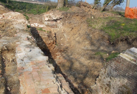
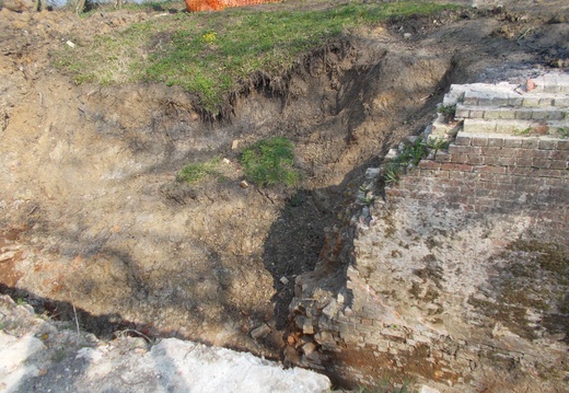
40 Section III - Grove Junction to S.Marston (E Summit lock) 1. Barwell Bridge SU 394891 Visited:- 6.8.60: 10.9.60: 13.5.61. Access:- Wantage Denceworth road. (not shown on 1:25000 sht SU38, airfield) Photograph Nos:- 33, 355 Observations:- Line practically obliterated here, recognisable to the east by double line of hedge (continuing from SI.25). About 70 yards east of road filling in progress. To west of road fill-in is old and complete; i.e. graded over making it difficult to distinguish line from adjacent field. Double hedge reappears about 200 yards west of road. No bridge remains, or road 'hump'. (13.5.61) found 20 yard section (at end of fill) containing a little water.

C.E. Faulkner Field Excursions 1958-66

Faulkner Log Page 041

41 2. Stockham Bridge SU 391888 Visited:- 13.5.61: 28.8.62. Access:- Lin walk from Barwell Br Photograph Nos:- 355, 454, 485 Observations:- Line filled, from water (see III. 1.) to farm track crossing, where much large masonry pieces strewn about, probably not canal work. Then good but overgrown line with water to Stockham Bridge (?). Rising ground to north called for deep cutting for about 500 yards, approximately 10 feet average, but about 20 feet most. West of bridge (which is filled) much overgrown and impassable. (26.8.62) revisit cutting section - able to get down to line which has about 12 inches of water for 200 to 300 yards: cutting compares with Sapperton east end.

C.E. Faulkner Field Excursions 1958-66

Faulkner Log Page 042

42 3. East Challow Bridge and Wharf SU 381884 Visited:- 6.8.60: 28.8.60: 3.6.61: 26.8.62. Access:- A 417 Photograph Nos:- 368,486 Observations:- No remains of bridge, but pronounced hump in road (A417). Crossing is railed either side against a drop of about 6 feet, probably indicating one-time brick or masonry structure. (3.6.61) East of bridge is open grassed space, possibly wharf, and on west side is period house (awaits confirmation). (26.8.62) Line becomes fairly distinct about 300 yards east of bridge: rubbish dump: infill east of bridge is very old.

C.E. Faulkner Field Excursions 1958-66

Faulkner Log Page 043

43 4. Occupation Bridge SU 375884 [Kings draw bridge. Doug S. Cornhill Labe bridge Gary K] Visited:- 6.8.60 Access:- A 417 Photograph Nos:- Observations:- (6.8.60 Line visible, e can be stotal overgrowth. Very narrow. Remains of simple plank bridge can be seen. Point? as a whole is hardly, recognisable for what it is. (NB. Two new and rather ugly bungalows recently erected hard by).

C.E. Faulkner Field Excursions 1958-66

Faulkner Log Page 044

44 West Challow Bridge SU 368883 Visited:- 6.8.60: 26.8.62. Access:- A 417 Photograph Nos:- 487 Observations:- See no 4. No trace of bridge, except for railings. Heavy willow growth, especially in bed of canal to west of crossing. (26.8.62) No appreciable change, but p.

C.E. Faulkner Field Excursions 1958-66

Faulkner Log Page 045

45 New Road Bridge SU 357887 Visited:- 7.8.60 Access:- From B 4507 in Sparsholt Photograph Nos:- Observations:- No bridge, but crossing is railed: road not humped. Very overgrown, but dry channel discernable each side by penetrating growth. Easier on east side, where a considerable quantity of rubbish has been tipped.

C.E. Faulkner Field Excursions 1958-66

Faulkner Log Page 046

46 Broadleaze Farm SU 341889 Visited:- 7.8.60 Access:- B 4507 via Westcot Lane Photograph Nos:- Observations:- Dense vegetation to the east of crossing: but on west side fairly open for several hundred yards. Channel full of reeds and somewhat indistinct passing by Broadleaze farm house.

C.E. Faulkner Field Excursions 1958-66

Faulkner Log Page 047

47 Kingston Common Farm SU 330889 Visited:- 7.8.60: 10.9.60: 22.9.60: 16:8:64 Access:- B 4507 via Kingston Lisle Photograph Nos:- 331, 332 Observations:- Channel to east very confused and overgrown: fairly open to west, but rather shapeless. (10.9.60) Milestone found, about 140 yards west of crossing, on south bank. Apparently limestone block, inscription side leaning towards canal, and much weathered. Figure '39' can be discerned (see 1880 map). West of milestone line narrows again and becomes more definite. (16.8.64) No change.

C.E. Faulkner Field Excursions 1958-66

Faulkner Log Page 048

48 9. Uffington Arch Bridge SU 313897 Visited:- 7.8.60: 28.8.60. Access:- From Kingston Lisle Photograph Nos:- Observations:- No significant trace. Crossing railed, but no elevation. Growth very dense indeed, line fairly discernable on west side. [continuation from page 49. Gary K] distance, then dense growth and line is narrow. also walked about 300 yards west but line overgrown, embankment not so high: line further to railway curve, very difficult.

C.E. Faulkner Field Excursions 1958-66

Faulkner Log Page 049

49 6. Uffington Wharf Bridge SU 300898 Visited:- 7.8.60: 10.9.60: 22.9.60: 13.5.61. Access:- From Uffington Photograph Nos:- 358, 360 Observations:- (7.8.60) Comparatively well preserved spot. Traces remain of parapets of masonry bridge(?) and distinct road hump. Embanking again in evidence:- to the east for some distance, but filling has taken place, and to the west where line and bank are very open and visible. Northwest curve to railway is very weakened[?]. Wharf cottage remains apparently in inhabited condition: there is a very ugly pre-fabricated dwelling on the wharf-canal site. (13.5.61) Walked about 400 yards east, well defined line in high embankment approximately 15 feet. Quite dry and clear over [Cont. opposite] [Page 48]

C.E. Faulkner Field Excursions 1958-66

Faulkner Log Page 050

50 Longcot Bottom Lock SU 279895 Visited:- 10.9.60 Access:- From Longcot old wharf, very tough going. Photograph Nos:- 336 Observations:- actual lock site not certainly detected as line is densely overgrown in this region: probably lies in thickly wooded copse. Embankment fairly substantial to railway. Overline railway bridge partially demolished and arch filled in with continuation of railway embankment: but portions of bridge abutments on west side still remain. (p336)

C.E. Faulkner Field Excursions 1958-66

Faulkner Log Page 051

51 Longcot Top Lock and Old Wharf SU 275893 Visited:- 7.8.60: 10.9.60 Access:- From Uffington Photograph Nos:- 335 Observations:- Lock probably just west of bridge, but no remains seen. Remaining parapet (low) of bridge in existence, but arch filled with masonry //. Line west very overgrown with reeds etc.. Two buildings:- (a) cottage northeast of bridge, apparently period. (b) somewhat older(?) cottage northwest.

Faulkner Log Page 052

52 Longcot Branch and New Wharf Visited:- 13.5.61: 3.6.61. Access:- From road crossing, B 4508 (Br). Photograph Nos:- 206, 370, 537 Observations:- B4508 bridge practically levelled (slight hump), and railed, some traces of original masonry, south parapet at road level, but north ditto [parapet] not visible:- arch appears bricked in. Bed south from bridge shows far line, moist bottom with water plants, some water in places. Walked to junction: (partly towpath, mostly adjacent fields) overgrowth increases in approaching it, and junction very grown over, including some fair size trees. Shape not well defined any longer. NB. From road, fields slope gently to the south, and bed runs in cutting

Faulkner Log Page 053

53 approximately 6 feet deep at road, diminishing progressively to junction where some embanking is visible. But north from road seen only: infill appears to commence about 100 yards north of bridge, where drop to bottom is about 17 feet. (3.6.61) Visited wharf house and met owners. Confirmed most of original conclusions. About 20 feet original stone edging can be seen, and garden has old stone //ting underneath lawn. Basin quite distinct, but weedy (rushes etc), contains water after rain.

Faulkner Log Page 054

54 Bowle's Bridge SU261889 Visited:- 17.5.58: 11.9.59: 3.10.59: 18.6.60: 7.8.60: 22.9.60: 13.5.61: 26.8.62: 2.9.62: 16.8.64: 21.9.64. Access:- Minor road from B 4508 Photograph Nos:- 489, 536 Observations:- Small crossing, filled in, and railed. Heavy tree growth to east and west, but line visible to west, with rubbish. Towpath to west can be followed. (18.6.60) Line almost completely obliterated by infill for about 100 yards to west, many trees down, etc.. (22.9.60) No exceptional change from previous observation. (13.5.61) No change. West, infill now becoming grassed over. Walked to end of fill (approximately 100 yards), line reappears, with little water in places. Also some fill east of bridge where line is virtually shapeless. (26.8 & 2.9) p to west of infill section (16.8.64 & 21.9.64) No change.