 Image credit: Swindon Museum and Art Gallery/ Art UK. Artist: G. Puckey. 1877.")
 Image credit: Local Studies, Swindon Central Library. 1953, Man with a stick. Canal towpath, possibl...")
Image credit: Local Studies, Swindon Central Library. 1953, Man with a stick. Canal towpath, possibly standing next to Cambria Baptist church
 Image credit: Local Studies, Swindon Central Library. 1953, Man with a stick. Canal in the backgroun...")
Image credit: Local Studies, Swindon Central Library. 1953, Man with a stick. Canal in the background
 (7453 visits) 1959, Swindon, looking west from Cambria Road Bridge")
1959, Swindon, looking west from Cambria Road Bridge
 (6737 visits) 1962, Swindon, looking west from a point west of Cambria road bridge")
1962, Swindon, looking west from a point west of Cambria road bridge
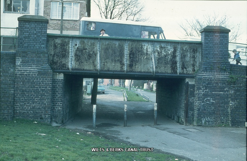
 1977, Cambria Road Bridge")
1977, Cambria Road Bridge
 1977, Swindon looking south")
1977, Swindon looking south
 1977, Tow rope marks Cambria bridge")
1977, Tow rope marks Cambria bridge
 1978, Cambria Bridge repairs")
1978, Cambria Bridge repairs
 1978, Tow rope marks west side Cambria bridge")
1978, Tow rope marks west side Cambria bridge
 Image credit: Local Studies, Swindon Central Library. Artist: Ken White, c1979
Cambia Road Bridge M...")
 Image credit: Local Studies, Swindon Central Library. Artist: Ken White, c1979
Cambria Road Bridge")
 Image credit: Local Studies, Swindon Central Library. Artist: Ken White, c1979
Cambria Road Bridge")
 Image credit: Local Studies, Swindon Central Library. Artist: Ken White, c1979
Cambia Road Bridge M...")
Image credit: Local Studies, Swindon Central Library. Artist: Ken White, c1979
Cambia Road Bridge Mural
 Image credit & Artist: Ken White, c1979
Cambia Road Bridge Mural")