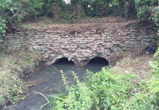
West Leaze Aqueduct
Historic Map
Your browser does not support the audio element.
This aqueduct is a double arch stone water bridge, built in 1803 by David Burrell & Co for the Canal Company and cost £56 11s 9d.
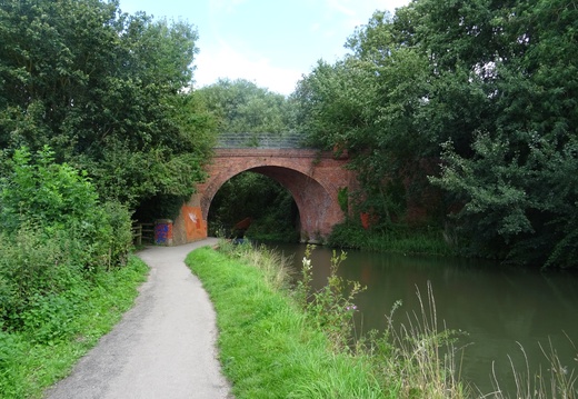
Railway/ Skew Bridge
Historic Map
Your browser does not support the audio element.
Skew bridge is a single arch bridge railway bridge, built in 1883 for the Swindon, Marlborough & Andover Railway, which then became the Midland & South Western Railway.
The line ran from Cirencester to Swindon Old Town and closed in 1961.
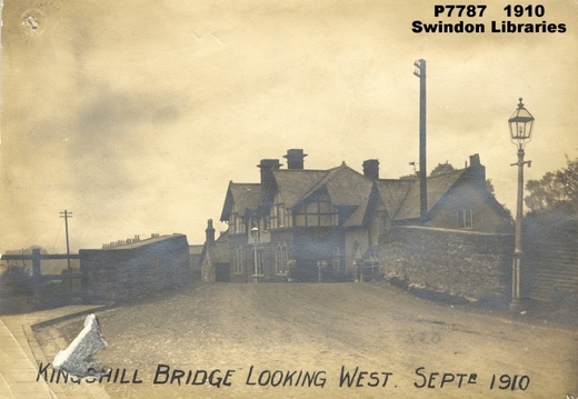
Kingshill Bridge
Your browser does not support the audio element.
Kingshill bridge was a stone single arch road bridge, built in 1803 by David Burrell for the Canal Company and cost £43 12s 3d.
This bridge was demolished during the canal infilling between 1920-22, when embanked approaches were levelled and the road straightened and widened.
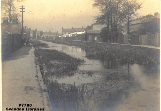
Marlborough Street/ Joseph Street Bridge
Historic Map
Your browser does not support the audio element.
Marlborough Street or Joseph Streetbridge was a steel flat footbridge, built in 1898 by for the Swindon Corporation.
This bridge was demolished between 1920-22.
Cambria Bridge
Historic Map
Google Street View
Your browser does not support the audio element.
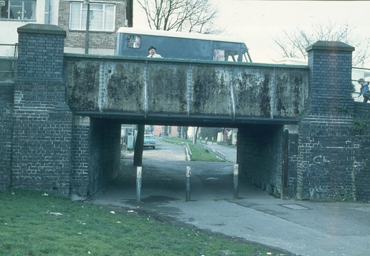
Cambria bridge was first built in 1877 by James Hilton, a speculative builder.
A wharf for Webb's timber yard was situated just south of the bridge on the eastern bank.
This bridge was widened and strengthened in 1893 by Swindon New Town Local Board at a cost of £1500.
Due to corrosion, the main span was replaced in 1978 by Thamesdown Council with a reinforced concrete span with brick parapets surmounted by steel railings. The original brick abutments were retained and the protective iron plate on the corner of the northern abutment, on the towpath side, shows characteristic rope wear grooves.
Black Bridge
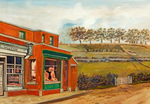
Image credit: Swindon Museum and Art Gallery. Artist: G. Puckey
Historic Map
Black bridge can just be seen in the background to the right

Commercial Road/ Milton Road Bridge
Historic Map
Your browser does not support the audio element.
Commercial Road Bridge, also known as Milton Road Bridge, replaced Black Bridge and sited 60 yards to the east of it. A wharf was situated on the south bank just east of this bridge.
Commercial Road Bridge was the only bridge in Swindon to exhibit any signs of architectural merit. With its elegant low bow arch, stone balustrades contrasting with the brickwork, and ornamental lamp posts at all four corners, it must have looked very attractive in its heyday.
Steps and slopes going down to the canal level were removed some time before 1960 and access from Milton Road fenced off. In 1977, steps at the Northwest corner were rebuilt to provide access to the Brunel Centre.
Both frontages of the brick arch were given an extra skin of new bricks in April 1981 and the old stone balustrades removed and replaced by concrete block and bricks.
Milestone
Historic Map
Google Street View
Your browser does not support the audio element.
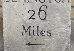
This milestone is a Grade 2 listed structure.
Installed in 1804 on the canal bank opposite to the towpath, then during the Brunel Plaza expansion in the early 1970's it was uprooted and stored in the Swindon Museum, then in 1976 the Milestone was re-installed in what would have been on the towpath side of the canal, this meant the arrow was pointing in the wrong direction, so a local stone mason changed the direction of the arrow.
Golden Lion/ Regents Street Bridge
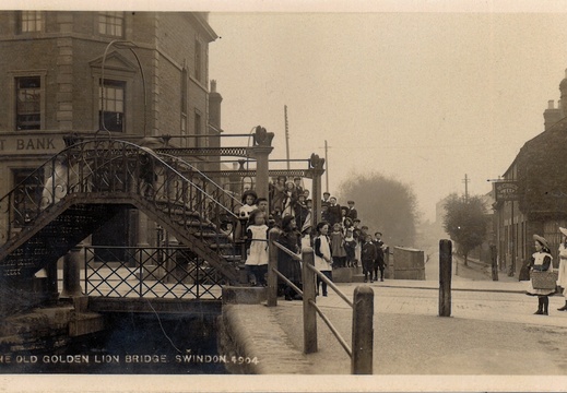
Image credit: Swindon Library
Historic Map
Your browser does not support the audio element.
Our next stopping off point is the famous Golden Lion Bridge, there is so much to say about this bridge that it would make a story all of its own
The first Bridge was built out of wood in 1800 to connect two muddy fields and was called Bridge Lane, later Bridge Street, one end of which joined Fleet Way which later became Fleet Street, the second was built by the old town traders in 1863 at a cost of £600 and was very ornate, before this most of the shops were on the Bridge Street side of the canal, which had not only shops in it but also three places of worship and seven pubs
The bridge itself had to be wound up and down by two men one on each pillar, but one of the pillars started to slip into the canal and it had to be closed down again after just nine months for repairs, the third and undoubtedly the most famous was the beautiful pedestrian bridge built it was said so the factory workers could not claim to be late because the bridge was up, this Bridge cost £94 to construct and would you believe it when they pulled it down no one knows what happened to it
For those who do not know the Golden Lion name came from the public house close by, with a Golden Lion itself was over the top of the entrance to the door, this Pub closed its doors for the last time on March the 15th 1956
It was the tradition in those days to name pubs after heraldic Shields thus in Britain we have many Red Lions and white lions but few golden lions, the Golden Lion was the crest on the shield held by Richard the lionheart of England who it is said added the third lion laying down on the top of his shield so that his men could pick him out in battle
The lion we see here today is not the original one that was taken down from the top of the pub, when the tram lines were repaired, someone noticed that each time a tram went by the lion wobbled, so he was put on the ground and he was surrounded by a fence, some say the fence was to stop children from sitting on his back and pulling his ears, but I prefer to believe it was to stop that lion from escaping
During the second World War the railings were removed for the war effort, then sometime later the lion himself was taken away by the council and put into storage, in the winter of 1963 that was the big freeze, someone decided that poor old lion might get cold so they put a tarpaulin in over the top of him and they tied it down, that line had stood up to everything that the weather could throw at him for over a hundred years, but he could not stand sweating under that tarpaulin and when it was removed many months later the stone had crumbled and his nose his ears and his feet had all fallen off, our lion was dead
When the Brunel was built it was thought a good idea to get another Golden Lion and put in his place, on February 25th 1977 the new lion was unveiled to Mark the Queen's silver jubilee and a teacher of a local school came up the idea of his class putting a box of all the things they used to use underneath the lion for him to protect, what will they find in that box I wonder when the lion is next removed
Narrator - Roy Cartwright
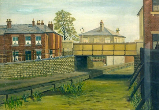
Queenstown/ Wellington Street Bridge
Image credit: Swindon Museum and Art Gallery. Artist: G. Puckey. 1885
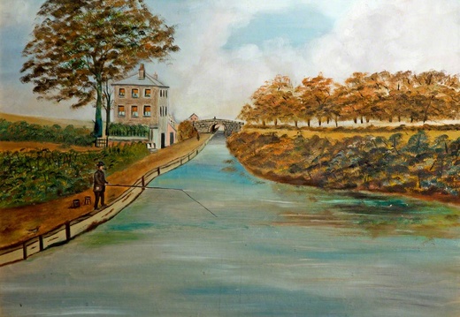
Whale Bridge & Cetus Buildings
Image credit: Swindon Museum and Art Gallery. Artist: G. Puckey
Historic Map
Whale bridge was originally a stone arch road bridge, built between 1803 and 1804 for the canal company and then reconstructed to a flat span steel bridge in 1893 by the Swindon Corporation at a cost of £1200.
This bridge took its name from the nearby Whale pub, which in turn was named after the old Cetus or Whale buildings next door.
A Wharf was situated on the south bank, east of the bridge.
This bridge was demolished during the construction of Fleming Way in 1963.
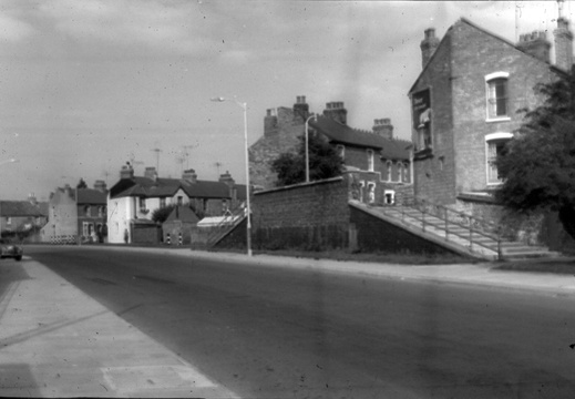
York Road Bridge
Historic Map
Your browser does not support the audio element.
York Road Bridge which was more ornate than Cambria bridge was a road bridge built by the Swindon Corporation between 1907-8, demolished during the construction of Fleming Way in 1963.
The bridge span over the canal was 31 feet and the width along the canal 42 feet. The span was flat steel with brick abutments and steel sheet sides.
The bridge abutments and steps on the north bank down to canal level still remain, although the southern abutment has been greatly shortened.
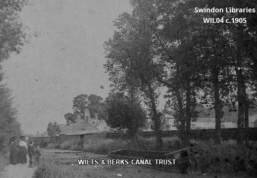
Swindon Wharf
In 1803 land for the wharf was purchased from William Bradford for £810, in 1804 a warehouse was built by William Quarell for 11 pounds, 11 shillings and 5 1/2 pence and in 1805 the canal managers house was built by Edward Weeks for £210.
Drove Road Bridge
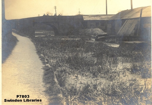
Drove road bridge was a stone arch road bridge, built between 1803 and 1804 for the Canal Company.
This bridge carried the turnpike road to Cricklade.
Adjacent is the Swindon Wharf and the canal managers villa.
The towpath changed banks here, being on the north bank west and the south bank east of the bridge.
This bridge was demolished between 1921 to 1922, with culverts because the canal was still watered on either side at this time.
The Canal thought to have been filled in between 1922 and 1924.>
Marsh Farm Bridge & Feeder
Historic Map
Your browser does not support the audio element.
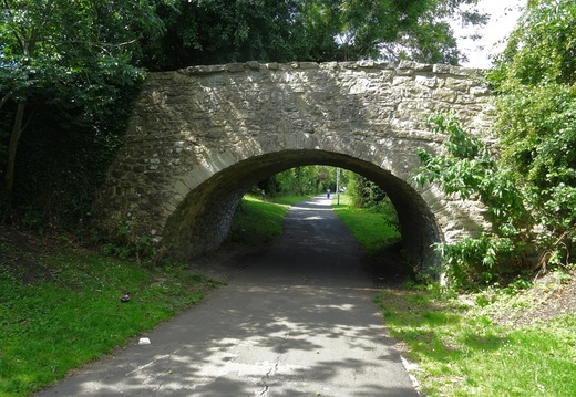
Marsh Farm Bridge is a Grade 2 listed structure. Built as a stone farm accommodation bridge in 1803 by Thomas Blinman for the Canal Company, it cost £35 pounds 7 shillings and 2 pence.