Wantage Wharf to the Mainline

0.8 Miles, Level, No locks, 1 Bridge

References, L.J. Dalby book, Know Your Place map
074644E
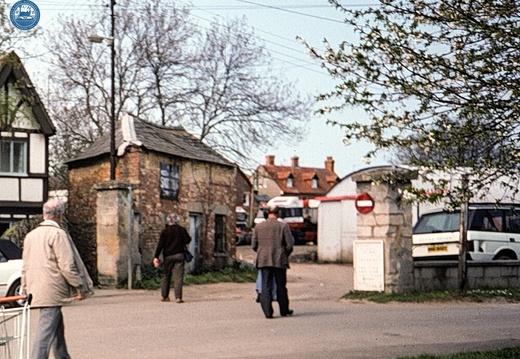
Image credit: RCHS. c1980's, Wantage branch, Wharf entrance.
197 Remains of Stockham Bridge 391888 Jan 1979
1979, Remains of Stockham Bridge
198 East from Hunters Bridge Jan 1979
1979, East from Hunters Bridge
199 Looking west from Barwell Bridge site 394891 June 1979
1979, Looking west from Barwell Bridge site
2.1.1 Wantage Branch (204n)
1959, Wantage branch, Wharf Warehouse & Granary
2.1.2 Wantage Branch (205n)
1959, Wantage branch, Wharf House
2.1.3 Wantage Branch (354n)
1961, Wantage branch, Wharf Weighbridge Building called the "Sack House"
2.1.4 Wantage Branch (366n)
1961, Wantage branch, Wharf entrance
2.2 Wantage Branch 05 (351n)
1961, Wantage branch, Belmont bridge
2.3.1 Wantage Branch (352n)
1961, Wantage branch, line looking north
2.3.2 Wantage Branch (353n)
1961, Wantage branch line looking south
202 Wantage Junction 395891 June 1979
1979, Wantage Junction
203 Settling Pond Wantage Arm 889396 June 1979
1979, Settling Pond Wantage Arm
204 Wantage Arm 395890 June 1979
1979, Wantage Arm
205 Remains of Belmont Bridge Wantage 397884 June 1979
1979, Remains of Belmont Bridge Wantage