4. Occupation Crossing, SU162850
Visited 19.6.60;
Access: TP from wharf site. Photograph Nos.: 237; 238; 239.
Observations: V. good example of overline Br. more or less intact, w. TP under. Much rubbish deposited. Line E & W from here is very distinct, and TP is surfaced between here and wharf site. A portion between here & Swindon Wharf is to be preserved water-filled (letter from S/don Boro Engr., 27.6.61). 19.3.89. I wonder if this was ever done?
4. Occupation Crossing, SU162850 Visited 19.6.60; Access: TP from wharf site. Photograph Nos.: 237; 238; 239. Observations: V. good example of overline Br. more or less intact, w. TP under. Much rubbish deposited. Line E & W from here is very distinct, and TP is surfaced between here and wharf site. A portion between here & Swindon Wharf is to be preserved water-filled (letter from S/don Boro Engr., 27.6.61). 19.3.89. I wonder if this was ever done?

Swindon Wharf, SU159849
Visited: 19.6.60; 3.6.61.
Access: A420.
Photograph Nos: -
Observations: line W. from (4) ends abruptly in filling for ‘roundabout’ foundation. Wharf bldgs. &c, demolished some time ago, and Boro’ Fire Stn. erected on the site. Line W. surfaced FP on TP side. Wharf building dem. about 1956. There was large ho. “Fairholme” beside Whf, (?Wharfinger’s), dem. 1936 for Steel’s Garage site. Whf. abt. 200’ long, and cocoa factory nearby – 1/2560 O.S. Sht XV. 4 of 1886. (letter from Boro. Eng. 27.6.61).
Swindon Wharf, SU159849 Visited: 19.6.60; 3.6.61. Access: A420. Photograph Nos: - Observations: line W. from (4) ends abruptly in filling for ‘roundabout’ foundation. Wharf bldgs. &c, demolished some time ago, and Boro’ Fire Stn. erected on the site. Line W. surfaced FP on TP side. Wharf building dem. about 1956. There was large ho. “Fairholme” beside Whf, (?Wharfinger’s), dem. 1936 for Steel’s Garage site. Whf. abt. 200’ long, and cocoa factory nearby – 1/2560 O.S. Sht XV. 4 of 1886. (letter from Boro. Eng. 27.6.61).

71
SUB-SECTION IV A. (Swindon Wharf to West Leaze Farm).
Visited: 19.6.60; 4.6.61; 27-30.8.62.
Access: - .
Photograph Nos. -
Swindon, a village when the Canal was built nearby, grew to be a large town during the 19th Cent., as a result of its choice by Brunel & Gooch as a site for the G.W. Rly Works. Therefore it was the only large town along the Canal which had the waterway in its midst; and in consequence the further growth of the town was always influenced by the Canal, inasmuch as the latter, before its abandonment, had to be bridged whenever new street layouts crossed it. The effect of the Canal line was to leave at most places, a clear ‘space’ right through the town; and although at the time of writing (26.8.69) it is being further obliterated by development work, yet enough is left for clear identification of its course and effect [sic]. However, the course of change is such, that even items and features non-existent in 1880 (6” O.S. WILTS SH. 15) are now being demolished! This part of the line is here commented upon as a special sub-section, for the sake of clarity and continuity.
(Features not shown on SH. 15 are *). Refer also to letter from S/don Boro Engr. Dated 27.6.61.
71 SUB-SECTION IV A. (Swindon Wharf to West Leaze Farm). Visited: 19.6.60; 4.6.61; 27-30.8.62. Access: - . Photograph Nos. - Swindon, a village when the Canal was built nearby, grew to be a large town during the 19th Cent., as a result of its choice by Brunel & Gooch as a site for the G.W. Rly Works. Therefore it was the only large town along the Canal which had the waterway in its midst; and in consequence the further growth of the town was always influenced by the Canal, inasmuch as the latter, before its abandonment, had to be bridged whenever new street layouts crossed it. The effect of the Canal line was to leave at most places, a clear ‘space’ right through the town; and although at the time of writing (26.8.69) it is being further obliterated by development work, yet enough is left for clear identification of its course and effect [sic]. However, the course of change is such, that even items and features non-existent in 1880 (6” O.S. WILTS SH. 15) are now being demolished! This part of the line is here commented upon as a special sub-section, for the sake of clarity and continuity. (Features not shown on SH. 15 are *). Refer also to letter from S/don Boro Engr. Dated 27.6.61.
72
See appendix p.84 description of changes
at the time of writing (26.8.69) it is being further obliterated by development work, yet enough is left for clear identification of its course and effect [sic]. However, the course of change is such, that even items and features non-existent in 1880 (6” O.S. WILTS SH. 15) are now being demolished! This part of the line is here commented upon as a special sub-section, for the sake of clarity and continuity.
(Features not shown on SH. 15 are *). Refer also to letter from S/don Boro Engr. Dated 27.6.61.
6. York Rd. Br. Blt. App. 1910, steel [w. concrete infill; dem. To extend (7); 1st part (Garrards front) dated 1958, to extend E. as dual way to R/about; & thus to Central Area (Br. Street de ).
72 See appendix p.84 description of changes at the time of writing (26.8.69) it is being further obliterated by development work, yet enough is left for clear identification of its course and effect [sic]. However, the course of change is such, that even items and features non-existent in 1880 (6” O.S. WILTS SH. 15) are now being demolished! This part of the line is here commented upon as a special sub-section, for the sake of clarity and continuity. (Features not shown on SH. 15 are *). Refer also to letter from S/don Boro Engr. Dated 27.6.61. 6. York Rd. Br. Blt. App. 1910, steel [w. concrete infill; dem. To extend (7); 1st part (Garrards front) dated 1958, to extend E. as dual way to R/about; & thus to Central Area (Br. Street de ).
73
From Wharf, line is well-defined space between walled buildings; abt. 50’ wide w. made-up T.P. as right-of-way: to
6. York Rd. Bridge [P. 240, 373, 374].* line narrows to pass beneath; a simple plate girder + underdeck, on wing walls and abutments of ‘railway’ brick, w. steps from TP 2 sides to road levels. (3.6.61) Demolition in progress. Steelwork gone & abutment walls being broken down. Rubble foundation centre of approach embanking thus visible. (see p.72).
Line from here abt. 30 yd. rubbish, then becomes:
7. Fleming Way [P 290; 375] *. A metalled road w. pavements & lighting (Garrard factory), abt. 500 yd. long; entered by road from either Newcastle St. or end of Medgbury Rd.; W. end terminates (3.6.61) in line of posts, barring traffic; where line again becomes rough grassed space,
73 From Wharf, line is well-defined space between walled buildings; abt. 50’ wide w. made-up T.P. as right-of-way: to 6. York Rd. Bridge [P. 240, 373, 374].* line narrows to pass beneath; a simple plate girder + underdeck, on wing walls and abutments of ‘railway’ brick, w. steps from TP 2 sides to road levels. (3.6.61) Demolition in progress. Steelwork gone & abutment walls being broken down. Rubble foundation centre of approach embanking thus visible. (see p.72). Line from here abt. 30 yd. rubbish, then becomes: 7. Fleming Way [P 290; 375] *. A metalled road w. pavements & lighting (Garrard factory), abt. 500 yd. long; entered by road from either Newcastle St. or end of Medgbury Rd.; W. end terminates (3.6.61) in line of posts, barring traffic; where line again becomes rough grassed space,
74 * 30.8.62. 'WHALE' GONE, BUT NOT BR.
still no TP as far as:
8. ‘Whale’ Bridge [242, 243, 291, 513]
blt. prob. abt. 1910, similarity to (6): “Whale Hotel” adjacent, Medgbury Rd, late 19th Cent. or early 20th; access from old TP in steps, but doubtful if canal use; line continues under Br., as open space (w. hardcore dump for future use), past remains of demolished TP side canal Inn “Golden Lion” (dem. 1958) ; ‘Whale’ Br. Scheduled for demolition late 1961. * 30.8.62. ‘Whale’ gone, but not Br.
9. Wellington Street Br. [244].
This was a fixed steel-girder Br. crossing at end of W. St., built 1881 demolished in 1920, probably as a result of work on (10) below.
10. Swindon Junction
with N. Wilts Canal (later Branch of W & B, see Section V), large open space, characteristically triangular in shape, now car and lorry park.
74 * 30.8.62. 'WHALE' GONE, BUT NOT BR. still no TP as far as: 8. ‘Whale’ Bridge [242, 243, 291, 513] blt. prob. abt. 1910, similarity to (6): “Whale Hotel” adjacent, Medgbury Rd, late 19th Cent. or early 20th; access from old TP in steps, but doubtful if canal use; line continues under Br., as open space (w. hardcore dump for future use), past remains of demolished TP side canal Inn “Golden Lion” (dem. 1958) ; ‘Whale’ Br. Scheduled for demolition late 1961. * 30.8.62. ‘Whale’ gone, but not Br. 9. Wellington Street Br. [244]. This was a fixed steel-girder Br. crossing at end of W. St., built 1881 demolished in 1920, probably as a result of work on (10) below. 10. Swindon Junction with N. Wilts Canal (later Branch of W & B, see Section V), large open space, characteristically triangular in shape, now car and lorry park.
75
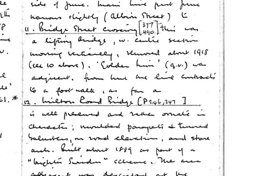
The “Union Hotel”, demolished 1959, now (1961) represented by open site on NW side of junc. Main line past Junc narrows slightly (Albion Street) to:
11. Bridge Street crossing [377, 490]
this was a lifting bridge, w. centre section moving vertically, removed about 1918 (see 10 above). ‘Golden Lion’ (Q.v.) was adjacent; from here the line contracts to a foot walk, as far as:
12. Milton Road Bridge [P 246, 247]
is well preserved and rather ornate in character; moulded parapets & turned balustraded, on road elevations, and stone arch. Built about 1889 as part of a “brighter Swindon” scheme. The area adjacent was described at the time as the “Little Venice of Swindon”(!). The Black Br. (see O.S. 1880) was sited abt. 200 ft w. of Milton Rd. Br. (opp line of Chester Street), demolished
75 The “Union Hotel”, demolished 1959, now (1961) represented by open site on NW side of junc. Main line past Junc narrows slightly (Albion Street) to: 11. Bridge Street crossing [377, 490] this was a lifting bridge, w. centre section moving vertically, removed about 1918 (see 10 above). ‘Golden Lion’ (Q.v.) was adjacent; from here the line contracts to a foot walk, as far as: 12. Milton Road Bridge [P 246, 247] is well preserved and rather ornate in character; moulded parapets & turned balustraded, on road elevations, and stone arch. Built about 1889 as part of a “brighter Swindon” scheme. The area adjacent was described at the time as the “Little Venice of Swindon”(!). The Black Br. (see O.S. 1880) was sited abt. 200 ft w. of Milton Rd. Br. (opp line of Chester Street), demolished
76
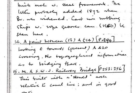
in 1890’s; line continues as open grassy track, w. few trees, to:
13. Cambria Road Bridge [P 250]
brick arch w. steel framework, the latter probably added 1892 when Br. Was widened. Cast iron rubbing strips w. rope grooves can (1960) be seen here.
14. A point between (13) & (14) [P 494]
looking E. towards (present) A420 crossing. No topographical information as to bridging there.
15. M. & S.W.J Railway Bridge [P253:256]
This built with a “skewed” arch relative to central line: and in good state.
16. ‘West Leaze’ Aqueduct [P 254].
Small intact structure carrying line over a brook, name unknown.
76 in 1890’s; line continues as open grassy track, w. few trees, to: 13. Cambria Road Bridge [P 250] brick arch w. steel framework, the latter probably added 1892 when Br. Was widened. Cast iron rubbing strips w. rope grooves can (1960) be seen here. 14. A point between (13) & (14) [P 494] looking E. towards (present) A420 crossing. No topographical information as to bridging there. 15. M. & S.W.J Railway Bridge [P253:256] This built with a “skewed” arch relative to central line: and in good state. 16. ‘West Leaze’ Aqueduct [P 254]. Small intact structure carrying line over a brook, name unknown.
77
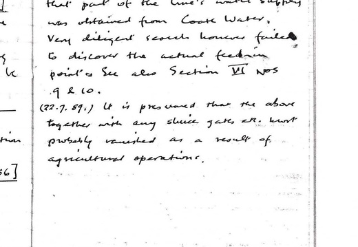
Note: Swindon lay on the canal’s summit pound: & it is thought that part of the line’s water supply was obtained from Coate Water. Very diligent search however failed to discover the actual feed-in point. See also Section VI nos. 9 & 10.
(22.7.89) It is presumed that the above together with any sluice gates etc. most probably vanished as a result of agricultural operations.
77 Note: Swindon lay on the canal’s summit pound: & it is thought that part of the line’s water supply was obtained from Coate Water. Very diligent search however failed to discover the actual feed-in point. See also Section VI nos. 9 & 10. (22.7.89) It is presumed that the above together with any sluice gates etc. most probably vanished as a result of agricultural operations.
78
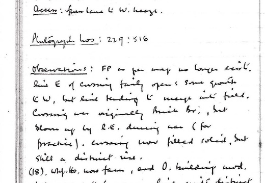
18a. Occupation Crossing, SU133827.
18. Wroughton Wharf, SU129823
Visited (18a) 30.8.62. (18) 14.9.59
Access from lane to W. Leaze.
Photograph Nos. 229: 516. Observations: FP as per map no longer exists, line E of crossing fairly open: some growth to W, but line tending to merge into field. Crossing was originally Brick Br., but blown up by R.E. during war (for practice). Crossing now filled solid, but still a distinct rise.
(18) Wharf Ho. was farm, and O. buildings mod. & converted to fm. uses, line quite distinct w. open space where goods loaded. House not v. typical, & suspect re-building. [18a poss. now obliterated by M4].
78 18a. Occupation Crossing, SU133827. 18. Wroughton Wharf, SU129823 Visited (18a) 30.8.62. (18) 14.9.59 Access from lane to W. Leaze. Photograph Nos. 229: 516. Observations: FP as per map no longer exists, line E of crossing fairly open: some growth to W, but line tending to merge into field. Crossing was originally Brick Br., but blown up by R.E. during war (for practice). Crossing now filled solid, but still a distinct rise. (18) Wharf Ho. was farm, and O. buildings mod. & converted to fm. uses, line quite distinct w. open space where goods loaded. House not v. typical, & suspect re-building. [18a poss. now obliterated by M4].
79
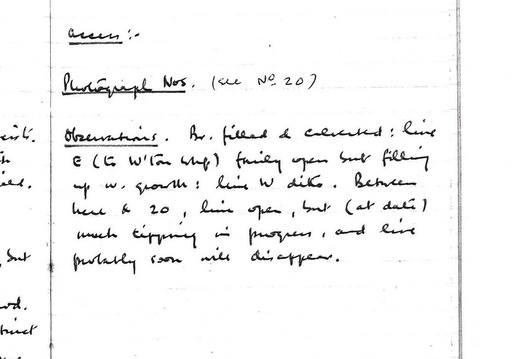
19. Hay Lane Crossing, etc. SU125821
Visited 30.8.62.
Access: - .
Photograph Nos. (See No. 20).
Observations. Br. Filled & culverted: line E (to W'ton Whf) fairly open but filling up w. growth: line W ditto. Between here & 20, line open, but (at date) much tipping in progress, and line probably soon will disappear.
79 19. Hay Lane Crossing, etc. SU125821 Visited 30.8.62. Access: - . Photograph Nos. (See No. 20). Observations. Br. Filled & culverted: line E (to W'ton Whf) fairly open but filling up w. growth: line W ditto. Between here & 20, line open, but (at date) much tipping in progress, and line probably soon will disappear.
80
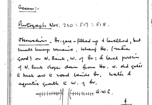
Hay Lane Wharf, SU109821
Visited 14.9.59; 30.8.62.
Access:-
Photograph Nos. 230, 517, 518.
Observations: Br. Gone – filled up & levelled, but small hump remains. Wharf Ho. (rather good) on N. Bank, W of br. & level portion of N. Bank slopes down from Ho. w. old gates & track out to road beside Br. Water & aquatic growth to W. of Br.
80 Hay Lane Wharf, SU109821 Visited 14.9.59; 30.8.62. Access:- Photograph Nos. 230, 517, 518. Observations: Br. Gone – filled up & levelled, but small hump remains. Wharf Ho. (rather good) on N. Bank, W of br. & level portion of N. Bank slopes down from Ho. w. old gates & track out to road beside Br. Water & aquatic growth to W. of Br.
81
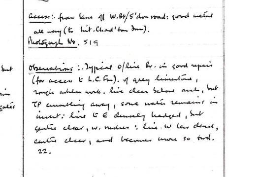
21. Chaddington Lane Bridge. SU095815
Visited 30.8. 62.
Access: from lane off W. Bt./S'don road; good metal all way (to Lit. Chad'ton Fm).
Photograph No. 519.
Observations: Typical o/line Br. in good repair (for access to L C Fm), of grey limestone, much ashlar work. Line clear below arch, but TP crumbling away, some water remaining in invert: line to E densely hedged, but centre clear, w rushes; line W less dense, centre clear, and becomes more so toward 22.
81 21. Chaddington Lane Bridge. SU095815 Visited 30.8. 62. Access: from lane off W. Bt./S'don road; good metal all way (to Lit. Chad'ton Fm). Photograph No. 519. Observations: Typical o/line Br. in good repair (for access to L C Fm), of grey limestone, much ashlar work. Line clear below arch, but TP crumbling away, some water remaining in invert: line to E densely hedged, but centre clear, w rushes; line W less dense, centre clear, and becomes more so toward 22.
82
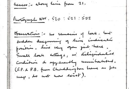
Chaddington Lock (W. Summit), SU092817
Visited 30.8.62. Access: along line from 21.
Photographs 520, 521, 522.
Observations: No remains of lock, but sudden deepening of line indicates position, line very open just here. Small lock cottage, in dilapidated condition & apparently uninhabited (F.P & F.B. from Chaddington Lane as per map, do not now exist).
82 Chaddington Lock (W. Summit), SU092817 Visited 30.8.62. Access: along line from 21. Photographs 520, 521, 522. Observations: No remains of lock, but sudden deepening of line indicates position, line very open just here. Small lock cottage, in dilapidated condition & apparently uninhabited (F.P & F.B. from Chaddington Lane as per map, do not now exist).
83
Special Notes, &c, on Section IV (April 63: based on observations 60-62):
1. Traceability. Fairly good outside Swindon: but E. of S/don much less so than W. The line through Swindon (although not canal-like and more) is quite obvious, because of the way in which the line originally divided the town: although converted by S.B.C. to other uses (roads, etc.) it has nowhere built on, in the town.
2. Condition. Coverage w. of S/don: usual shapelessness, & varying amounts of growth. E. of S/don, much obliterated. On short section W. of Hay Lane Whf (q.v.) contains a fair amount of water, but ‘channel’ restricted by rushes, &c.
3. Characteristics. None special; the line follows a course of gentle curves across the pasture & arable of the ‘Swindon plateau’; a fair number of crossings, and the line never very far from main roads.
83 Special Notes, &c, on Section IV (April 63: based on observations 60-62): 1. Traceability. Fairly good outside Swindon: but E. of S/don much less so than W. The line through Swindon (although not canal-like and more) is quite obvious, because of the way in which the line originally divided the town: although converted by S.B.C. to other uses (roads, etc.) it has nowhere built on, in the town. 2. Condition. Coverage w. of S/don: usual shapelessness, & varying amounts of growth. E. of S/don, much obliterated. On short section W. of Hay Lane Whf (q.v.) contains a fair amount of water, but ‘channel’ restricted by rushes, &c. 3. Characteristics. None special; the line follows a course of gentle curves across the pasture & arable of the ‘Swindon plateau’; a fair number of crossings, and the line never very far from main roads.