52
Longcot Branch and New Wharf
Visited:- 13.5.61: 3.6.61.
Access:- From road crossing, B 4508 (Br).
Photograph Nos:- 206, 370, 537
Observations:- B4508 bridge practically levelled (slight hump), and railed, some traces of original masonry, south parapet at road level, but north ditto [parapet] not visible:- arch appears bricked in.
Bed south from bridge shows far line, moist bottom with water plants, some water in places. Walked to junction: (partly towpath, mostly adjacent fields) overgrowth increases in approaching it, and junction very grown over, including some fair size trees. Shape not well defined any longer.
NB. From road, fields slope gently to the south, and bed runs in cutting
52 Longcot Branch and New Wharf Visited:- 13.5.61: 3.6.61. Access:- From road crossing, B 4508 (Br). Photograph Nos:- 206, 370, 537 Observations:- B4508 bridge practically levelled (slight hump), and railed, some traces of original masonry, south parapet at road level, but north ditto [parapet] not visible:- arch appears bricked in. Bed south from bridge shows far line, moist bottom with water plants, some water in places. Walked to junction: (partly towpath, mostly adjacent fields) overgrowth increases in approaching it, and junction very grown over, including some fair size trees. Shape not well defined any longer. NB. From road, fields slope gently to the south, and bed runs in cutting
53
approximately 6 feet deep at road, diminishing progressively to junction where some embanking is visible. But north from road seen only: infill appears to commence about 100 yards north of bridge, where drop to bottom is about 17 feet.
(3.6.61) Visited wharf house and met owners. Confirmed most of original conclusions. About 20 feet original stone edging can be seen, and garden has old stone //ting underneath lawn. Basin quite distinct, but weedy (rushes etc), contains water after rain.
53 approximately 6 feet deep at road, diminishing progressively to junction where some embanking is visible. But north from road seen only: infill appears to commence about 100 yards north of bridge, where drop to bottom is about 17 feet. (3.6.61) Visited wharf house and met owners. Confirmed most of original conclusions. About 20 feet original stone edging can be seen, and garden has old stone //ting underneath lawn. Basin quite distinct, but weedy (rushes etc), contains water after rain.
54
Bowle's Bridge SU261889
Visited:- 17.5.58: 11.9.59: 3.10.59: 18.6.60: 7.8.60: 22.9.60: 13.5.61: 26.8.62: 2.9.62: 16.8.64: 21.9.64.
Access:- Minor road from B 4508
Photograph Nos:- 489, 536
Observations:- Small crossing, filled in, and railed. Heavy tree growth to east and west, but line visible to west, with rubbish. Towpath to west can be followed.
(18.6.60) Line almost completely obliterated by infill for about 100 yards to west, many trees down, etc..
(22.9.60) No exceptional change from previous observation.
(13.5.61) No change. West, infill now becoming grassed over.
Walked to end of fill (approximately 100 yards), line reappears, with little water in places. Also some fill east of bridge where line is virtually shapeless.
(26.8 & 2.9) p to west of infill section
(16.8.64 & 21.9.64) No change.
54 Bowle's Bridge SU261889 Visited:- 17.5.58: 11.9.59: 3.10.59: 18.6.60: 7.8.60: 22.9.60: 13.5.61: 26.8.62: 2.9.62: 16.8.64: 21.9.64. Access:- Minor road from B 4508 Photograph Nos:- 489, 536 Observations:- Small crossing, filled in, and railed. Heavy tree growth to east and west, but line visible to west, with rubbish. Towpath to west can be followed. (18.6.60) Line almost completely obliterated by infill for about 100 yards to west, many trees down, etc.. (22.9.60) No exceptional change from previous observation. (13.5.61) No change. West, infill now becoming grassed over. Walked to end of fill (approximately 100 yards), line reappears, with little water in places. Also some fill east of bridge where line is virtually shapeless. (26.8 & 2.9) p to west of infill section (16.8.64 & 21.9.64) No change.
55
Shrivenham Draw Bridge SU243883
Visited:- 11.9.59: 13.5.61
Access:- minor road from village
Photograph Nos:- 361
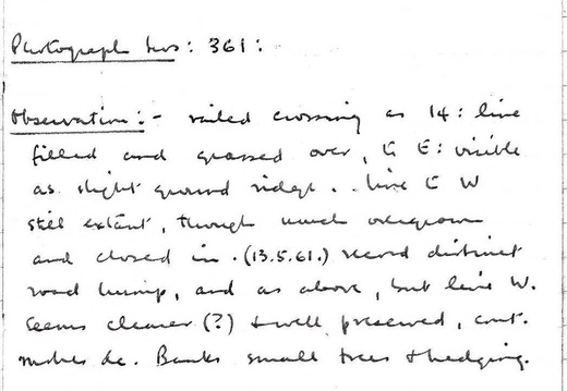
Observations:- Railed crossing as 14: line filled and grassed over; to east visible as slight ground ridge. Line to west still extant, though much overgrown and closed in.
(13-5-61) // distinct road hump, and as above, but line west seems clearer (?) and well preserved, //.etc.. Banks small trees and hedging.
55 Shrivenham Draw Bridge SU243883 Visited:- 11.9.59: 13.5.61 Access:- minor road from village Photograph Nos:- 361 Observations:- Railed crossing as 14: line filled and grassed over; to east visible as slight ground ridge. Line to west still extant, though much overgrown and closed in. (13-5-61) // distinct road hump, and as above, but line west seems clearer (?) and well preserved, //.etc.. Banks small trees and hedging.
![Faulkner Log Page 056 (705 visits) Page 56
56
Shrivenham Arch Bridge SU238879 [Station Road. Doug S]
Visited:- 15.9.59: 13.5.61... Faulkner Log Page 056](_data/i/upload/2024/04/09/20240409002432-ec8fecdf-cu_e520x360.jpg)
56
Shrivenham Arch Bridge SU238879 [Station Road. Doug S]
Visited:- 15.9.59: 13.5.61: 27:8:62: 16.8.64.
Access:- B 4000 from village
Photograph Nos:-
Observations:- Line runs in deepish overgrown cutting here, and bridge has very little humping. Well preserved bridge; possibly renovated parapets, but arch and towpath are original. Iron re-enforcing bar through arch crown: much rubbish dumped: but access to canal bed possible.
(13-5-61) No change from above, except increase in rubbish.
(29-8-62) No change, except heavier growth.
P. (16.8.64) ditto
56 Shrivenham Arch Bridge SU238879 [Station Road. Doug S] Visited:- 15.9.59: 13.5.61: 27:8:62: 16.8.64. Access:- B 4000 from village Photograph Nos:- Observations:- Line runs in deepish overgrown cutting here, and bridge has very little humping. Well preserved bridge; possibly renovated parapets, but arch and towpath are original. Iron re-enforcing bar through arch crown: much rubbish dumped: but access to canal bed possible. (13-5-61) No change from above, except increase in rubbish. (29-8-62) No change, except heavier growth. P. (16.8.64) ditto
57
17. Steppingstone Lane Arch Bridge Occupation Br SU235880
Visited:- 13.5.61: 29.8.62.
Access:- B 4000 to lower Bourton, then walk along green lane
Photograph Nos:- 497, 498
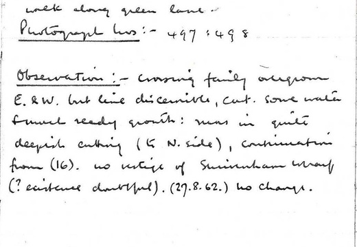
Observations:- Crossing fairly overgrown east & west , but line discernable, contains some water and much reedy growth: runs in quite deepish cutting (to north side), continuation from (16). No vestige of Shrivenham Wharf (? existence doubtful).
(27-8-62) No change.
57 17. Steppingstone Lane Arch Bridge Occupation Br SU235880 Visited:- 13.5.61: 29.8.62. Access:- B 4000 to lower Bourton, then walk along green lane Photograph Nos:- 497, 498 Observations:- Crossing fairly overgrown east & west , but line discernable, contains some water and much reedy growth: runs in quite deepish cutting (to north side), continuation from (16). No vestige of Shrivenham Wharf (? existence doubtful). (27-8-62) No change.
58
18. Bourton Wharf SU226879
Visited:- 13.5.61: 16.8.64
Access:- A 420
Photograph Nos:- 362, 363, 364, 499
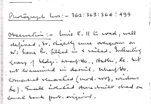
Observations:- Line east to road well defined, slightly more overgrown on west line. Bridge filled in and railed. Interesting group of buildings. Wharf house, stables etc., but not examined in detail. Wharf house somewhat renovated (modern roof, windows etc.). Small stone built shed on canal bank probably original.
(16-8-64) No change.
58 18. Bourton Wharf SU226879 Visited:- 13.5.61: 16.8.64 Access:- A 420 Photograph Nos:- 362, 363, 364, 499 Observations:- Line east to road well defined, slightly more overgrown on west line. Bridge filled in and railed. Interesting group of buildings. Wharf house, stables etc., but not examined in detail. Wharf house somewhat renovated (modern roof, windows etc.). Small stone built shed on canal bank probably original. (16-8-64) No change.
![Faulkner Log Page 059 (670 visits) Page 59
59
19. Railway (G.W.R.) Bridge *SU 218875 [Acorn Bridge. Doug S]
Visited:- 11.9.60:... Faulkner Log Page 059](_data/i/upload/2024/04/09/20240409002433-36f00b4b-cu_e520x360.jpg)
59
19. Railway (G.W.R.) Bridge *SU 218875 [Acorn Bridge. Doug S]
Visited:- 11.9.60: 13.5.61.
Access:- A 420
Photograph Nos:- 365, 345
Observations:- Interesting two arch brick bridge carrying railway over road and canal on skewed line. Canal line very overgrown through bridge, and embanked about three feet above road; very overgrown. Canal also accessible through hedge at small lay-by about half mile west of bridge on A420, but full of rubbish.
(27-8-62) No change.
Later revisited: no change, but line moderately distinct //hedges. p.
*Also believe known as "Acorn Bridge"
59 19. Railway (G.W.R.) Bridge *SU 218875 [Acorn Bridge. Doug S] Visited:- 11.9.60: 13.5.61. Access:- A 420 Photograph Nos:- 365, 345 Observations:- Interesting two arch brick bridge carrying railway over road and canal on skewed line. Canal line very overgrown through bridge, and embanked about three feet above road; very overgrown. Canal also accessible through hedge at small lay-by about half mile west of bridge on A420, but full of rubbish. (27-8-62) No change. Later revisited: no change, but line moderately distinct //hedges. p. *Also believe known as "Acorn Bridge"
60
20. Acorn Bridge (fm), S Marston SU 208874
Visited:- 13.5.61
Access:- A 420
Photograph Nos:-
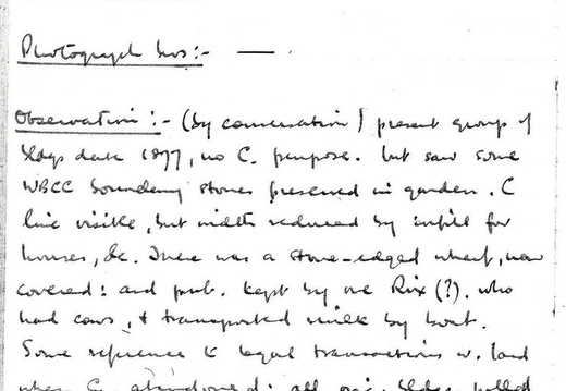
Observations:- (by communication) present group of buildings date from 1877; no canal purpose. Saw some WBCC boundary stones preserved in garden. Canal line visible, but width reduced by infill for houses etc.. There was a stone edged wharf, now covered, and pub kept by Rix(?) who had cows, and transported milk by boat. Some reference to legal transactions with land when canal was abandoned: all original buildings pulled down с1877(?).
60 20. Acorn Bridge (fm), S Marston SU 208874 Visited:- 13.5.61 Access:- A 420 Photograph Nos:- Observations:- (by communication) present group of buildings date from 1877; no canal purpose. Saw some WBCC boundary stones preserved in garden. Canal line visible, but width reduced by infill for houses etc.. There was a stone edged wharf, now covered, and pub kept by Rix(?) who had cows, and transported milk by boat. Some reference to legal transactions with land when canal was abandoned: all original buildings pulled down с1877(?).
61
21. Longleaze Farm SU 204872
Visited:- 12.9.59: 11.9.60: 3.6.61.
Access:- A 420
Photograph Nos:- 343, 344
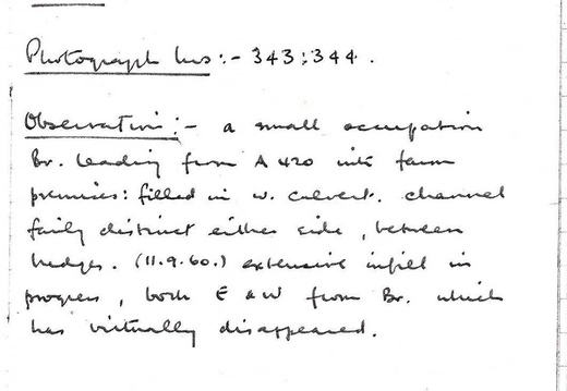
Observations:- A small occupation bridge leading from the A420 into farm premises: filled in with culvert. channel fairly distinct either side, between hedges.
(11.9.60) Extensive infill in progress, both east and west from bridge, which has virtually disappeared.
61 21. Longleaze Farm SU 204872 Visited:- 12.9.59: 11.9.60: 3.6.61. Access:- A 420 Photograph Nos:- 343, 344 Observations:- A small occupation bridge leading from the A420 into farm premises: filled in with culvert. channel fairly distinct either side, between hedges. (11.9.60) Extensive infill in progress, both east and west from bridge, which has virtually disappeared.
63
23. South Marston Top Lock and House SU 195867
Visited:- 11.9.60
Access:- A 420
Photograph Nos:- 342, 340, 341
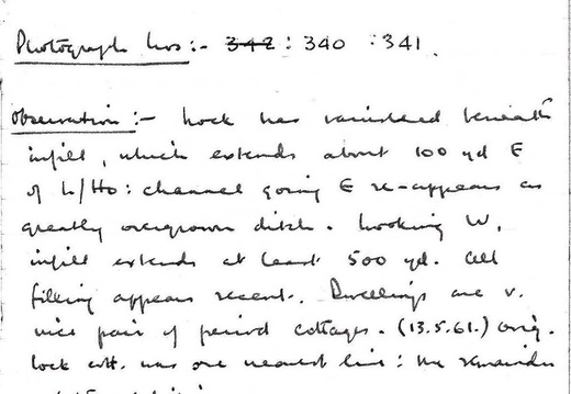
Observations:- Lock has vanished beneath infill, which extends about 100 yeards east of lock house: channel going east re-appears overgrown ditch. Looking west infill extends at least 500 yards. All filling appears recent. Dwellings are very nice pair of period cottages.
(13.5.61) Original lock cottage was one nearest canal line: the remainder a later addition.
63 23. South Marston Top Lock and House SU 195867 Visited:- 11.9.60 Access:- A 420 Photograph Nos:- 342, 340, 341 Observations:- Lock has vanished beneath infill, which extends about 100 yeards east of lock house: channel going east re-appears overgrown ditch. Looking west infill extends at least 500 yards. All filling appears recent. Dwellings are very nice pair of period cottages. (13.5.61) Original lock cottage was one nearest canal line: the remainder a later addition.
![Faulkner Log Page 064 (668 visits) Page 64
64
Special notes etc. on Section III [Wantage to South Marston]
(June 1961: based o... Faulkner Log Page 064](_data/i/upload/2024/04/09/20240409002435-815c8d6f-cu_e520x360.jpg)
64
Special notes etc. on Section III [Wantage to South Marston]
(June 1961: based on 1960 & 1961 observations)
1. TRACEABILITY: Line generally not quite so good as Section I [Abingdon to Wantage]. All crossings can be found; in some cases exploration therefore is very limited: dense undergrowth.
2. CONDITION: Fair where embanking or cutting exists; otherwise much obliteration; especially West of Grove Top Lock to Barwell Bridge, between West Challow and Uffington, East of Shrivenham Draw Bridge, and Longleaze Farm to South Marston Top Lock.
About quarter mile east of Stockham Bridge (q.v.) has water. Very overgrown: West Challow, Uffington Arch, below Longcot old wharf. Reasonably clear elsewhere.
3. CHARACTERISTICS: Less embanking than Section I and possibly more cutting. (v. Stockham bridge & Shrivenham arch et seq.) Line is rising into quasi-downland country, more contour variations and directional changes (Brindley system!) especially Uffington & Shrivenham.
4. LOCKS: Six only this section, of these Longcot Top and all South Marston flight (4) are gone. Longcot
64 Special notes etc. on Section III [Wantage to South Marston] (June 1961: based on 1960 & 1961 observations) 1. TRACEABILITY: Line generally not quite so good as Section I [Abingdon to Wantage]. All crossings can be found; in some cases exploration therefore is very limited: dense undergrowth. 2. CONDITION: Fair where embanking or cutting exists; otherwise much obliteration; especially West of Grove Top Lock to Barwell Bridge, between West Challow and Uffington, East of Shrivenham Draw Bridge, and Longleaze Farm to South Marston Top Lock. About quarter mile east of Stockham Bridge (q.v.) has water. Very overgrown: West Challow, Uffington Arch, below Longcot old wharf. Reasonably clear elsewhere. 3. CHARACTERISTICS: Less embanking than Section I and possibly more cutting. (v. Stockham bridge & Shrivenham arch et seq.) Line is rising into quasi-downland country, more contour variations and directional changes (Brindley system!) especially Uffington & Shrivenham. 4. LOCKS: Six only this section, of these Longcot Top and all South Marston flight (4) are gone. Longcot
65
Bottom perhaps exists, but overgrowth too dense to verify.
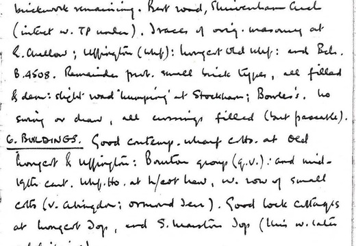
BRIDGES: Thirteen fixed road bridges on main line plus one on Longcot Branch, and two railway bridges. Best remaining (for obvious reasons) is G.W.R. at SU 218875: that at Longcot filled, but some brickwork remaining. Best road bridge is Shrivenham Arch (intact with towpath under it). Traces of original masonry at East Challow, Uffington (Wharf), Longcot Old Wharf, and Bridge B4508.
Remainder probably small brick type; all filled and demolished: slight humping at Stockham and Bowles's. No swing or draw bridges, all crossing filled (but passable)
BUILDINGS: Good contemporary wharf cottages at Old Longcot and Uffington, Bourton group (q.v), and mid 19th century Wharf House at Longcot new, with row of small cottages (v. abingdon: ormond terrace). Good lock cottages at Longcot Top and South Marston Top (this with later additions).
7. REMARKS: Milestone (Semington 39) found west of Kingston Common Bridge. Various WBCC boundary marker stones seen at South Marston wharf site.
65 Bottom perhaps exists, but overgrowth too dense to verify. BRIDGES: Thirteen fixed road bridges on main line plus one on Longcot Branch, and two railway bridges. Best remaining (for obvious reasons) is G.W.R. at SU 218875: that at Longcot filled, but some brickwork remaining. Best road bridge is Shrivenham Arch (intact with towpath under it). Traces of original masonry at East Challow, Uffington (Wharf), Longcot Old Wharf, and Bridge B4508. Remainder probably small brick type; all filled and demolished: slight humping at Stockham and Bowles's. No swing or draw bridges, all crossing filled (but passable) BUILDINGS: Good contemporary wharf cottages at Old Longcot and Uffington, Bourton group (q.v), and mid 19th century Wharf House at Longcot new, with row of small cottages (v. abingdon: ormond terrace). Good lock cottages at Longcot Top and South Marston Top (this with later additions). 7. REMARKS: Milestone (Semington 39) found west of Kingston Common Bridge. Various WBCC boundary marker stones seen at South Marston wharf site.
SECTION IV – S. Marston Top Lock to Chaddington Lock (Summit Level).
1. Stratton Wharf, SU186861,
Visited 11.9.60; 13.5.61; 27.8.62.
Access: A419 crossing;
Photograph Nos: 339, 500.
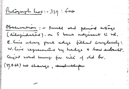
Observations: Small old period cottage (dilapidated), on S. bank adjacent to rd. E. line along park edge filled completely; W. line represented by hedge & low embank. Slight road hump for site of old br. (27.8.62) no change.
SECTION IV – S. Marston Top Lock to Chaddington Lock (Summit Level). 1. Stratton Wharf, SU186861, Visited 11.9.60; 13.5.61; 27.8.62. Access: A419 crossing; Photograph Nos: 339, 500. Observations: Small old period cottage (dilapidated), on S. bank adjacent to rd. E. line along park edge filled completely; W. line represented by hedge & low embank. Slight road hump for site of old br. (27.8.62) no change.
